South Queensferry Branch (North British Railway)
Introduction
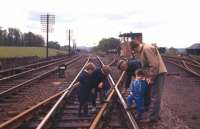
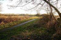
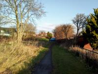
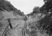
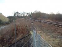
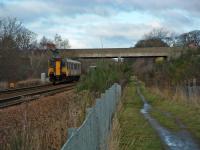
This single track line is closed, except for a short section near Dalmeny, south of the station. Ground was taken for two tracks, but for most of its length only one line was laid (the northbound).


 //")


Locations along the line
These locations are along the line.
This junction was east of Ratho station (on the 1842 Edinburgh and Glasgow Railway) and Ratho (Low Level) (on the 1866 South Queensferry Branch (North British Railway)), formed with the branch opened.
...
See also
Edinburgh and Glasgow Railway
Frank Spaven Collection (Courtesy David Spaven) 30/04/1961
This was a single platform station on the South Queensferry Branch (North British Railway) immediately north of Ratho on the Edinburgh and Glasgow Railway. The junction between the main line and its branch was just to the east at Queensferry Junction.
...
Ewan Crawford //1997
John Yellowlees 30/07/2018
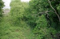
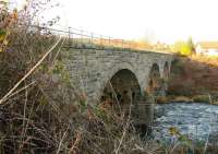
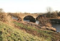
To the south of Kirkliston station the line passed over the River Almond. Although built as a double track viaduct it only carried the south end of the loop.
...
John Furnevel 13/01/2012
John Furnevel 13/01/2012
John Furnevel 13/01/2012
David Panton /04/1995
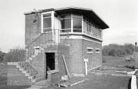
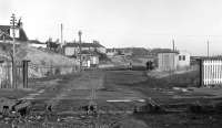
This was a single platform station. The platform was on the west side of the line and there was a loop on the east side. The goods yard, looped sidings, was on the east side. The signal box was on the west side at the south end of the platform. This opened in 1894, not long after the Forth Bridge route opened.
...
David Panton 17/12/2019
Frank Spaven Collection (Courtesy David Spaven) //
...
More details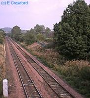
Ewan Crawford //
...
Bill Roberton 28/08/1976
...
David Spaven //1973
This was a four way junction. The 1868 was crossed by the 1890 Forth Bridge Connecting Lines (North British Railway) which joined the line from south east and left the older line to the north west of the junction.
...
See also
Forth Bridge Connecting Lines (North British Railway)
...
Bill Roberton //1978
Ewan Crawford 28/12/2003
Array
More detailsThe original Dalmeny station was about a mile south of the current Dalmeny station and on a different, now closed, alignment. It was immediately north of Dalmeny South Junction. It was built a quarter of a mile south of Dalmeny itself to avoid being located in a cutting.
...
Ewan Crawford 28/12/2003
...
More details
Malcolm Chattwood 14/06/2023
Bill Roberton 09/09/2014
This was a single platform minor station. The timber platform was on the north side of the line. There was a waiting shelter at the west end of the platform and also at the west end the signal for the line to Port Edgar and the goods yard, formerly the terminus of the line, South Queensferry [1st]. There was a siding to the east. This station replaced the terminus. It closed with the ...
More detailsSee also
Port Edgar Extension (North British Railway)
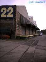
This was the terminus of the line from South Queensferry Junction, Ratho. The line was single track and approached the terminus from the east. East of the single platform was a loop. The platform was on the north side of the single line with a small building. The goods yard was on the north side of the line, approached also from the east.
...
Malcolm Chattwood 15/06/2023

