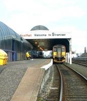
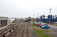
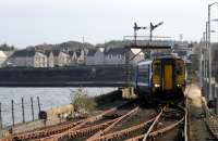
Stranraer

A cross-section of the Rhinns from the OS One Inch map of 1925 showing the length of the Portpatrick branch. One wonders why Colfin station couldn't either have been nearer Colfin or called something else. The rectangle on the pier at Stranraer is Harbour station and the lack of colour would normally indicate that it was closed. This is shurely shome mishtake as it's been open continuously since the line opened (as far as I know). The stormy petrel has lost its 'y' (were they consulted?) since a previous owner of the map spotted one at Portpatrick in 1952. Crown copyright 1925.
Location: Stranraer
Original line: Maps
Photographer: David Panton
Contact photographer: David Panton
Date: 1925
Image number: 33026
Tags: MapOther photographs of Stranraer on RailScot
 |  |  |  |  |  |  |  |  |  |
