Lossiemouth
Location type
StationName and dates
Lossiemouth (1852-1964)Opened on the Morayshire Railway.
Description
This was a single platform station with a large goods yard. The yard was located to the east of the passenger station and extended to the quaysides of the inner harbour.
The station was the terminus of the line from Elgin East, five miles south, and being the oldest station in the area was worthy of preservation. Unfortunately the H-plan station building was demolished around 1988 as it had become disused before the line closed. Alongside this, to its immediate south, was the Steamboat and Railway Hotel, formerly the company offices of the Morayshire Railway company (demolished at the same time as the station building). The platform remains.
The approach from the south parallels the older Spynie Canal for some distance. The canal is largely a drain, built around 1811, for the low lying flat land and Loch Spynie.
When built this line, the Morayshire Railway, existed in isolation. It connected Elgin to the sea at Lossiemouth. The harbour was expanded with the inner dock for the opening of the railway. The harbour was home to a fishing fleet and market and import/export for Elgin, one use being for the import of previously used sherry casks for the whisky industry (the Morayshire was extended south towards Speyside reaching further distilleries, particularly around Rothes, in 1858).
The offices and waiting room portion of the building was a single storey. There was an adjoining two storey hotel.
A signal box opened in 1896. This was on the east side of the line at the south end of the station.
The site is now a car park and parkland ('railway park'), but the long curved platform survives. A short portion of tramway remains embedded in the east side of the dock.
The station was rebuilt at least once, and land recovered from the sea to allow its expansion. More sidings, on a curve, were added to the east of the passenger platform (which was also altered).
The station closed to passengers in 1964. The goods yard, signal box and line closed in 1966.
The Moray Coast Trail passes through the station site. To the north and west it continues to Hopeman where it takes to the former branch trackbed. To the east is runs along the shoreline, after crossing the Lossie on a footbridge, to run to Garmouth where it takes to the old line and the Speymouth Viaduct to cross the River Spey. The sand beach at Seatown apparently was reinforced with training walls for the River Lossie made from old carriages around 1900.
Local
RAF Lossiemouth is to the west of Lossiemouth.
Tags
Station terminusExternal links
Canmore site recordNLS Collection OS map of 1892-1914
NLS Collection OS map of 1944-67
NLS Map
NLS Map
06/08/2021


| Nearby stations Rifle Range Halt Greens of Drainie Calcots Elgin East Elgin Urquhart Hopeman Cummingston Lhanbryde Mosstowie Garmouth Burghead [2nd] Longmorn Burghead [1st] Coltfield Platform | Morayshire Brick and Tile Works Lossie Junction Lossie Viaduct Elgin Gas Works Elgin Shed [2nd] Elgin East Coal Yard Elgin East Junction Elgin Shed [1st] Tourist/other RAF Lossiemouth Spynie Palace Duffus Castle Linksfield Level Crossing St Peter^s Kirk and Parish Cross Duffus Elgin Cathedral Ladyhill Castle |
| Location names in dark blue are on the same original line. | |
Chronology Dates
| 16/07/1846 | Morayshire Railway Act receives Royal assent. Authorised from Lossiemouth to Elgin [GNSR] and from Orton to Craigellachie. |
| 10/08/1852 | Morayshire Railway Line opens from Elgin [GNSR] to Lossiemouth. |
| / /1903 | Great North of Scotland Railway
Alford Valley Railway
Inverury and Old Meldrum Junction Railway
Morayshire Railway
St Combs Light Railway (Great North of Scotland Railway) Railcars used on the Alford, Old Meldrum, Lossiemouth and St Combs lines. Bodies for these experimental railcars were built at the Inverurie Works, the steam engines were by Andrew Barclay, Sons & Co and the boilers by Cochran's Boiler Works. |
| 06/04/1964 | Morayshire Railway Lossiemouth to Elgin East (Lossie Junction) closed to passengers. |
| 28/03/1966 | Morayshire Railway Elgin East to Lossie Junction to Lossiemouth closed to freight. |
News items
| 18/03/2021 | Pictures from the Past: 1964 Last train to Lossie [Northern Scot] |
Books
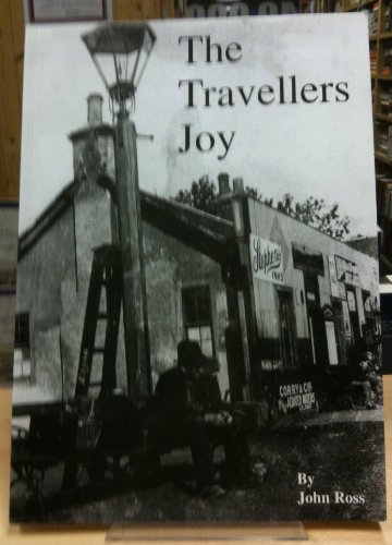 The Travellers Joy: The Story of the Morayshire Railway |
