Kicking Horse Pass

A plan of the twin spirals of the Kicking Horse Pass on the BC/Alberta border. These are on the Canadian Pacific route, taking a more southerly course than the CNR, originally involving the very punishing 'Big Hill' with a gradient of 1:23 and reaching an altitude of 5,338 feet. In 1909 this was replaced by a system of tunnels and twin spirals with a mere 1:46 gradient. The original alignment has now been subsumed by Trans-Canada Highway 1.
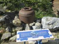
A panel at the viewing area beside Highway 1 explains much more clearly than the view through the trees of this feat of engineering. Trains tend to be sent through in batches, so if you hear one but miss it the chances are another will head in the same direction in about 20 minutes.
Location: Kicking Horse Pass
Original line: Canadian Pacific Railway
Photographer: Mark Wringe
Contact photographer: Mark Wringe
Date: 16/08/2013
Image number: 56382
Other photographs of Kicking Horse Pass on RailScot
 |

