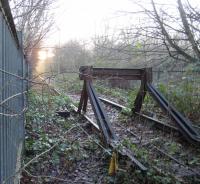
Bonnington South Junction

From old maps this looks to have been the site of Bonnington South Junction but the underbridge is not shown. Nowadays it is part of the Water of Leith Walkway. Note the sustainable materials used to form earth-retaining structures at the base of the embankments allowing the path to snake down and under the bridge. The track is still there but it is closed off by heavy steel fencing.
Location: Bonnington South Junction (former)
Original line: Easter Road Deviation (North British Railway)
Photographer: Charlie Niven
Contact photographer: Charlie Niven
Date: 10/11/2023
Image number: 88090
Other photographs of Bonnington South Junction on RailScot
 |  |

