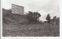
Silverstripe Saw Mill

The 1923 Edition of the 25 OS map shows a more restricted tramway system than the 1901 map. Aerial photos taken in 1933 and 1948 show that the tramway consisted of narrow gauge tracks with small trolley-like flat wagons. These were probably hand-propelled down to the loading bank level and around the site between the stacks of cut timber. By 1948 the site had been re-arranged so that the tramway no longer reached the siding and the operators needed to use some other means of transport to get the wood to the railway wagons. Research for caption text by Charlie Niven. Reproduced with the permission of the National Library of Scotland. See https://maps.nls.uk/index.html Examples of aerial Images include: https://www.britainfromabove.org.uk/en/image/SPW042235 from 1933 and https://www.britainfromabove.org.uk/en/image/SAW016812 from 1948
You need to register to zoom into these images.
Location: Silverstripe Saw Mill
Original line: Deeside Railway
Photographer: National Library of Scotland
Contact photographer: National Library of Scotland
Date: 20/06/2021
Image number: 77276
Other photographs of Silverstripe Saw Mill on RailScot
 |  |

