Map

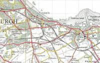
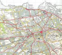
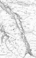
A map of the Balerno Branch, really a loop, which opened in 1874 and closed to passengers in 1943, closing entirely in 1967. Following this map, and over four days, will be a series of photographs illustrating an eastbound journey along the line from Ravelrig to Slateford using a mixture of 1960s and 1980s photographs (and a postcard) provided by Don Shaw. The single track line wended its way by the Water of Leith, crossing over the river multiple times and passing snuff and paper mills. Trains ran out from Edinburgh Princes Street, taking to the branch at Balerno Junction, and took 25 minutes to reach Balerno. [Map backdrop: Ordnance Survey.]
Location: Map
Original line: Balerno Branch (Caledonian Railway)
Photographer: Ewan Crawford
Contact photographer: Ewan Crawford
Photosets: Balerno Branch
Date: 24/12/2021
Image number: 79462
Other photographs of Map on RailScot
 |  |  |  |  |  |  |  |  |  |
