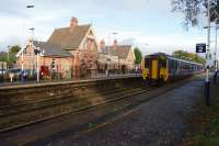
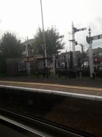
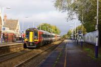
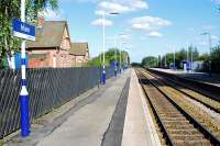
Irlam

25" map extract of Irlam, from the end of the 19th Century, showing the present day station and the railway diverging slightly to run parallel to its original route but on a rising gradient towards the Ship Canal bridge. The 1st station here opened in 1873 but closed in 1893 when the present facility opened (using the existing station building), adjacent to it but on this new alignment. The River Mersey, bottom right, was later diverted and heavy, rail served industry occupied the land but it is now a business park. Added by Mark Bartlett. Reproduced with the permission of the National Library of Scotland http://maps.nls.uk/index.html.
Location: Irlam
Original line: Manchester Ship Canal Deviations (Cheshire Lines Committee)
Photographer: National Library of Scotland
Contact photographer: National Library of Scotland
Date: 05/02/2025
Image number: 92160
Other photographs of Irlam on RailScot
 |  |  |  |
eBay may have some items listed below which may be of interest. RailScot is an eBay affiliate. Buying an item may help offset the running costs of the site.
