Camps Branch (North British Railway)
Introduction
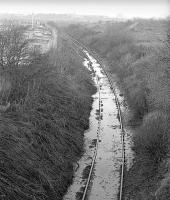
This branch served Camps and the Pumpherston Oil Works. It crossed the River Almond on a substantial viaduct, Camps Viaduct, near East Calder. The line was included in the North British Railway (Camps &c) Act (Act number c.ccxci). The portion to Camps was railway no 1 - 3 miles 42 chains from the Edinburgh and Bathgate Railway in the parish of Uphall to East Camps Lime Works in the parish of Kirknewton in the County of Edinburgh.


Dates
| /11/1913 | Raw Pit (East Calder) Closed by Coltness Iron Works for limestone (Raw Camps Quarry and East Camps Quarry). The Camps Branch (North British Railway) was directly associated with the quarry and carrying limestone from Camps Lime Works to the iron works. |
Locations along the line
These locations are along the line.
East of Uphall station was the junction for the Camps Branch (North British Railway). It was on the south side of the main line opposite Uphall Junction (slightly to the east). The junctions shared a signal box. The branch ran south to Camps Quarry and the Pumpherston Oil Works.
...
See also
Edinburgh and Bathgate Railway
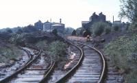
This was a shale crude oil works and refinery opened by the Pumpherston Oil Company. It was provided with shale, by rail, from a number of mines. The railway was the Camps Branch (North British Railway) of 1869.
...
See also
Pumpherston Oilworks Railways
Ewan Crawford 06/12/2003
Bill Roberton /01/1978
Douglas Blades 03/06/1970
Bill Roberton /01/1978
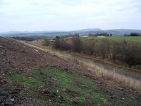
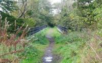
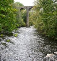
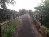
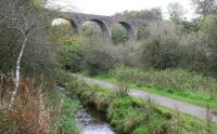
This is an impressive disused nine arch stone single track viaduct over the gorge of the River Almond. It is 118 yards long overall and 90 ft high. In addition to crossing the river it also passes over a canal feeder for the Union Canal.
...
John Furnevel 12/09/2010
John Furnevel 12/09/2010
John Yellowlees 22/07/2022
John Furnevel 12/09/2010
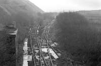
This goods depot consisted of a goods shed, two sidings, a crane and a weighing machine on the west side of the line, south of Camps Viaduct. Approach to the shed was from the south east, Camps quarries, direction.
...
...
More details...
More details