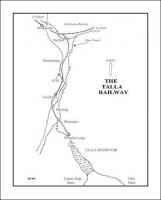
Map
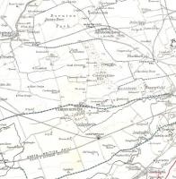
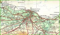
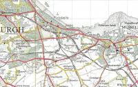
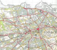
Part of Bartholomew's Six-inch to the Mile Plan of the City and Royal Burgh of Edinburgh, 1953-54, showing the eastern extremity of the city. It hasn't quite changed out of all recognition: most of the track is still there, and there's even still a field in the middle, but today this area contains more housing, a by-pass, a hypermarket and where formerly there was a 'coal pit' there are now 2 back-to back retail parks.
Location: Map
Company: Maps
Photographer: David Panton
Contact photographer: David Panton
Date: 1953
Image number: 33707
Other photographs of Map on RailScot
 |  |  |  |  |  |  |  |  |  |
