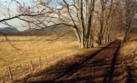
Bridge of Gairn

The 1900 edition of 1:2500 scale map shows the location of the terminus of the former Bridge of Gairn Tramway. Lying to the west of the River Gairn the area was shown as vegetation 30 years after the line was abandoned. The location of the abutments for the bridge are also clearly visible. The bridge was reused for a road across the river at Daldownie in Glen Gairn.
Map extract used with permission of the National Library of Scotland.
Location: Bridge of Gairn (former)
Original line: Bridge of Gairn Tramway (Aboyne and Braemar Railway)
Photographer: Charlie Niven
Contact photographer: Charlie Niven
Date: 04/05/2021
Image number: 76749
Other photographs of Bridge of Gairn on RailScot
 |

