Castle Douglas and Dumfries Railway
Introduction
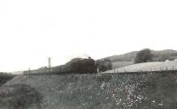
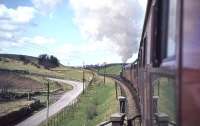
This railway is closed. The line was built between Dumfries (Glasgow, Dumfries and Carlisle Railway) and Castle Douglas. Castle Douglas became a junction for Stranraer (via the Portpatrick Railway) and Kirkcudbright (via the Kirkcudbright Railway). A short section of the line remained until 2002 between Dumfries and Maxwelltown. ScotRail provide passenger services from Dumfries to Glasgow Central and Carlisle.


Dates
Locations along the line
These locations are along the line.
This junction is just to the north of Dumfries station and the Edinburgh Road Bridge.
...
See also
Glasgow, Dumfries and Carlisle Railway
John Furnevel 01/09/2009
Brian Smith 18/03/2016
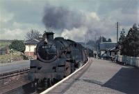
John Furnevel 17/04/2006
Bill Roberton 31/08/1985
This junction was at the north end of Dumfries station and was formed between the 1859 Castle Douglas and Dumfries Railway and the 1863 Dumfries, Lochmaben and Lockerbie Railway. To reach the D&CDR the DL&LR crossed the Glasgow, Dumfries and Carlisle Railway (Glasgow and South Western Railway main line) on the level.
...
See also
Glasgow, Dumfries and Carlisle Railway
Dumfries, Lochmaben and Lockerbie Railway
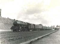
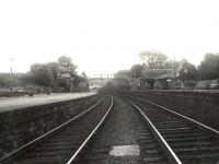
G H Robin collection by courtesy of the Mitchell Library, Glasgow 15/07/1961
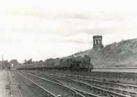
G H Robin collection by courtesy of the Mitchell Library, Glasgow 16/07/1961
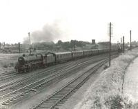
G H Robin collection by courtesy of the Mitchell Library, Glasgow 15/07/1961
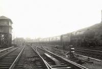
G H Robin collection by courtesy of the Mitchell Library, Glasgow 15/07/1956
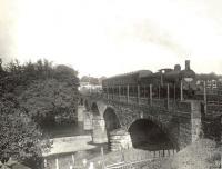
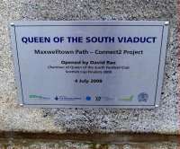
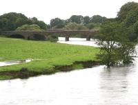
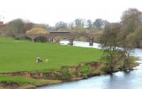
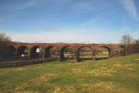
This is an eleven arch double track viaduct; five of 30ft at the east end and six over the river of 50ft at the west end.
...
G H Robin collection by courtesy of the Mitchell Library, Glasgow 16/07/1956
Brian Smith 27/02/2009
John Furnevel 01/09/2009
John Furnevel 17/04/2006
...
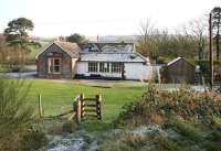
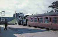
More detailsThis was a two platform station to the west of Dumfries. The main station building, of two storeys, was on the northbound (Dumfries bound) platform with a large shelter on the opposite platform. There was no footbridge, there being a road bridge at the north end.
...
Ross Wilson 26/05/2017
John Furnevel 27/05/2003
John Furnevel 29/05/2007
John Furnevel 29/05/2007
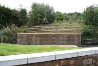
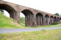
This is a disused double track eight arch masonry viaduct south of the former Maxwelltown station and just north of the former Maxwelltown Factory Siding. Also known as Cargenbridge Viaduct. The viaduct is 276 ft overall and 47 ft high.
...
John Furnevel 29/05/2007
John Furnevel 30/05/2007
John Gray 10/04/2010
Ken Strachan 16/03/2010
This was a siding for a Second World War munitions factory opened by the Ministry of supply in 1940. The siding made a trailing connection to the line west of Maxwelltown station and was approached by reversal from the west. The works, known as MoS Drungans (Dumfries), produced guncotton. This was converted to triple-base cordite at MoS Dalbeattie (Southwick Ammunition Factory) and into ...
More details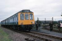
Roger Geach Collection 23/08/1975
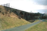
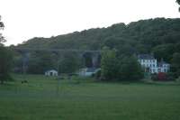
This is a fine eighteen arch double track masonry viaduct on a curve. It is 1011 ft long overall and 92 ft high.
...
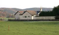
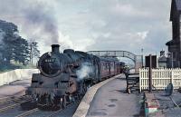
This was a two platform station with the east end located in a cutting on the approach to an overbridge. The main station building was on the westbound platform and there was a goods yard at the west end, south of the line, approached from the west.
...
This was a two platform station to the south of a level crossing. The main station building was on the westbound platform. There was a goods yard on the east side, approached from the south.
...
John Furnevel 09/11/2005
John Furnevel 09/11/2005
John Furnevel 01/09/2009
...
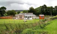
More detailsThis was a two platform station. The goods yard was on the east side, approached from the north, or by reversal from a spur from the south. The main station building was on the westbound platform.
...
John Furnevel 01/09/2009

John Furnevel 09/11/2005
John Furnevel 09/11/2005
G H Robin collection by courtesy of the Mitchell Library, Glasgow 16/07/1956
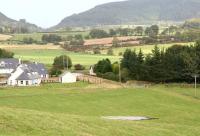
This was a two platform station. The main station building was on the westbound platform and there was a short siding at the west end, approached from the west.
...
...
More details
Ewan Crawford //2004
This was a two platform station in the north of Dalbeattie. It had a stone station building on the westbound platform and timber one on the eastbound.
...
Brian Haslehust 24/04/1965
G H Robin collection by courtesy of the Mitchell Library, Glasgow 14/07/1956
John Furnevel 29/05/2007
John Furnevel 29/05/2007
The original single track timber viaduct was replaced with a girder bridge in 1886. The replacement was built to allow a second track and the line was doubled in 1894.
...
G H Robin collection by courtesy of the Mitchell Library, Glasgow 16/07/1956
John Furnevel 01/09/2009
John Furnevel 31/05/2002
This station was also known as Buittle Mill, Buittle Halt and Buittle Mill Halt. It opened shortly after the line. It had a station building on a single platform and a siding. Services were limited calling on Wednesdays only with one train each way.
...
John Robin 15/04/1963
Array
More detailsThis was a two platform station in the north of Castle Douglas.
...
See also
Kirkcudbright Railway
Portpatrick Railway
Brian Haslehust 24/04/1965
Brian Haslehust 22/06/1964
Brian Haslehust 24/04/1965
Ewan Crawford //

