Forfar and Brechin Railway

Introduction

This line is closed. It opened in 1895 and was a single track line serving an agricultural area of low population and effectively paralleled the Strathmore main line. The route served an area which would have been served by some of the proposed, but unbuilt, routes of the Aberdeen Railway at its southern end.

A common service for passenger workings was from Brechin to Dundee East, going via Careston, Forfar [2nd], Kingennie and Broughty Ferry. Timings were quite tight, about 28 minutes from Brechin to Forfar [2nd].

It closed to passengers in 1952 and in 1958 a portion closed making it a branch from Forfar South Junction to Careston. This was further cut back to Justinhaugh in 1964 and the remainder closed in 1967 at the same time as the Strathmore main line itself closed to passengers and was reduced to a branch to Forfar [2nd] from Perth.

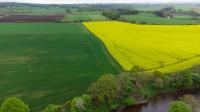
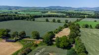
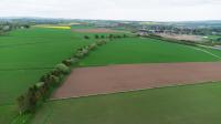
Structures were varied with some built in stone (abutments of large bridges, loading banks, bridges over roads) and others in concrete (station platforms and some of the small bridges over the line). Land was taken for two tracks, some structures were built for the two lines but only carried one.

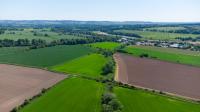
The largest structures on the line were the South Esk Viaduct [Tannadice] and smaller Noran Water Viaduct.


Dates

  /  /1890Forfar and Brechin Railway
Forfar and Brechin Railway authorised. Working agreement with Caledonian Railway concluded.
  /  /1893Brechin and Edzell District Railway Forfar and Brechin Railway
Agreements made for the west to north and east to north curves at Brechin.
  /  /1894Forfar and Brechin RailwayCaledonian Railway
Forfar and Brechin Railway authorisation for absorption by Caledonian Railway.
01/01/1895Forfar and Brechin Railway Caledonian Railway
Officially absorbed.
07/01/1895Forfar and Brechin Railway
Opened for goods from Brechin to Forfar South Junction. Tannadice station opened to goods.
01/06/1895Forfar and Brechin Railway
Opened for passengers from Brechin to Forfar South Junction with stations at Careston, Tannadice and Justinhaugh.
04/08/1952Forfar and Brechin Railway
Brechin to Forfar South Junction (excluded) closed to passengers. Careston, Tannadice and Justinhaugh closed to passengers.
17/03/1958Forfar and Brechin Railway
Brechin (excluded) to Careston (excluded) closed to freight
03/10/1960Forfar and Brechin Railway
Tannadice closed to goods.
07/09/1964Forfar and Brechin Railway
Careston to Justinhaugh (excluded) closed to freight.
04/09/1967Forfar and Brechin Railway
Justinhaugh to Forfar South Junction (excluded) closed to goods.

Portions of line and locations

This line is divided into a number of portions.


Forfar to Brechin

This junction was to the west of Forfar [2nd station, not so much south as more north west, indeed it was further north than Forfar North Junction which was east of Forfar [1st]. However in railway terms it was south of the station as it was closer to Perth.
...

More details

See also
Scottish Midland Junction Railway
These fields were once crossed by the Forfar and Brechin Railway as it approached Forfar South Junction. This part of the line has been ploughed out. ...
Ewan Crawford 18/07/2023
View west from Forfar showing the A90 and A926. Closer to the camera the original route of the A926 can be seen with the re-aligned version to its ...
Ewan Crawford 18/07/2023
At first it looks like there is nothing railway related in this view. Bottom right is bridge number 200 (Turfbeg Road Bridge) on the Strathmore main ...
Ewan Crawford 18/07/2023
Caledonian 0-4-4T 55194 takes the Brechin line at Forfar South Junction with the daily goods on 20 July 1953.
See
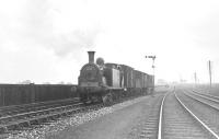
G H Robin collection by courtesy of the Mitchell Library, Glasgow 20/07/1953
4 of 6 images. more


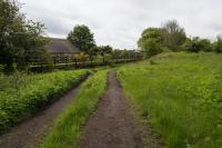
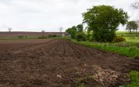
Cairn Siding did not open with the Forfar and Brechin Railway. It was a rural siding south west of Justinhaugh. The siding was on the north/west side of the line and approached from the Forfar [2nd] direction. There was a loading bank, a small hut and the line was crossed by a girder bridge here carrying a private road.
...

More details


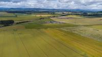
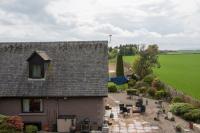
This was a two platform station with a passing loop. The main station building was on the westbound platform. There was a cottage in the station yard and a goods yard approached from the west. The signal box was at the west end of the eastbound platform. It opened with the line.
...

More details


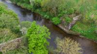
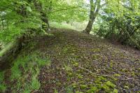
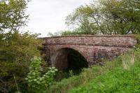
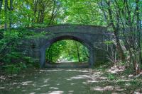
This single track viaduct carried the Caledonian Railway's Forfar and Brechin Railway over the South Esk just to the south of the village of Tannadice and west of Tannadice station. The abutments were built in stone, with substantial protection built around the piers for when the river was in spate.
...

More details
The South Esk Viaduct near Tannadice was the largest structure on the Forfar and Brechin Railway. This view looks south over its remains. It was a ...
Ewan Crawford 22/05/2023
View south west over the South Esk Viaduct at Tannadice showing the largely ploughed out route of the railway's course towards Justinhaugh and Forfar. ...
Ewan Crawford 22/05/2023
2 of 2 images.


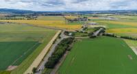
This was a single platform station, on the south side of the single track line, with a pair of sidings opposite the platform, approached from the east. There was a station building on the platform and station house to the west.
...

More details
Tannadice station was not in the village of the same name, but about two miles away by road. The station was to the north of Tannadice House. The ...
Ewan Crawford 22/05/2023
The loading bank at Tannadice station is made from an odd assortment of stone blocks, many of them dressed in various non matching styles. Perhaps ...
Ewan Crawford 22/05/2023
East of Tannadice the trackbed remains in good condition, so good that the sleeper indentations can be seen in the ballast for about a mile. ...
Ewan Crawford 22/05/2023
Tannadice was a single platform station with a loading bank opposite the passenger platform. The station is seen from the north east in a 2023 view. ...
Ewan Crawford 22/05/2023
4 of 6 images. more


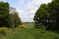
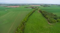
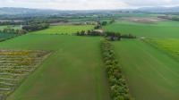
This was a double track viaduct, which only carried one track. It was the second largest structure on the Forfar and Brechin Railway (after the South Esk Viaduct [Tannadice]). The viaduct crossed the Noran Water which is in a deep tree-lined gully below the farmland to either side. It was located between Tannadice and Fern Siding. Only the westbound line was laid.
...

More details
The Noran Water Viaduct crossed the river in this great mass of trees. The line from Forfar approached from top centre and crossed the removed viaduct ...
Ewan Crawford 22/05/2023
The Noran Water has cut a deep tree-lined ravine which was crossed by the Forfar and Brechin Railway using this partly demolished viaduct, of which ...
Ewan Crawford 22/05/2023
Above Noran Water Viaduct looking south west to Tannadice. A portion of line has been ploughed out, but can still be seen as a crop mark, running from ...
Ewan Crawford 22/05/2023
Looking north east towards the Noran Water Viaduct from a minor road overbridge near Noranbank Farm. A cutting has been infilled and, beyond, the ...
Ewan Crawford 22/05/2023
4 of 6 images. more


This siding was located between Tannadice and Careston. It was a short siding on the north side of the line, approached from the east. It was directly west of a level crossing with Whammond's Loan, a road which has since fallen out of use. There was a railway cottage on the north side of the line and very short loading bank.
...

More details
Fern Siding was located about half way between Tannadice and Careston. The line was crossed on the level by Whammond's Loan here. This view looks ...
Ewan Crawford 22/05/2023
1 of 1 images.


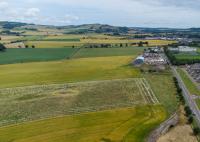
Located in a rural location to the north of Careston this was a two platform station with a passing loop and the main station building on the westbound platform.
...

More details
Looking away from Careston, near Findowrie Farm, with Brechin in the far distance top right. ...
Ewan Crawford 22/05/2023
This stone bridge crosses the deep cutting of the former line just north of Broomfield Farm, about half way between Careston station and Brechin North ...
Ewan Crawford 22/05/2023
Looking west to Careston station. The station site was the triangle of land in the middle distance with the goods yard to the left of the line. ...
Ewan Crawford 22/05/2023
Careston station site is now a house and its garden. There is a girder road bridge over the line to the east of the former station, this is the view ...
Ewan Crawford 22/05/2023
4 of 6 images. more


This was a junction between the Forfar and Brechin Railway lines (opened 1895) and the Brechin and Edzell District Railway line (opened 1896).
...

More details

See also
Brechin and Edzell District Railway
View north about a mile and a half north of Brechin, and north of the A90. A minor road crossed the line here - and the bridge has been infilled. The ...
Ewan Crawford 15/06/2023
View south showing the former Edzell branch petering out just north of Brechin. Once the line entered the town it swung tightly round to the left to ...
Ewan Crawford 15/06/2023
Bridge crossing the line west of Brechin North Junction, looking west. The track of the Forfar route was to the left and the Edzell branch line was on ...
Ewan Crawford 15/06/2023
The Forfar and Brechin Railway approaches the western edge of Brechin in this view. Montrose Basin can be seen distantly top right. The line met and ...
Ewan Crawford 22/05/2023
4 of 6 images. more


This junction was controlled by a ground frame. The east fork of the Forfar and Brechin Railway met the former Aberdeen Railway branch to Brechin at a junction which allowed running from the Forfar line to Bridge of Dun bypassing Brechin. Land was taken on this fork for two tracks, the same as the rest of the Forfar and Brechin Railway, although only one line was laid (the ...

More details

See also
Aberdeen Railway
View south east showing the approach of the Brechin 'bypass' which allowed trains from Forfar or Edzell to miss the station and continue east to ...
Ewan Crawford 15/06/2023
1 of 1 images.