Border Union Railway (North British Railway)

Introduction

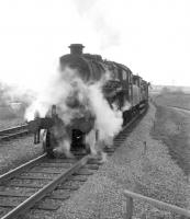
This line is closed. The railway formed an integral part of what became known as the Waverley Route which ran between Edinburgh Waverley and Carlisle. Its closure was one of the first mainline railway closures in Britain. Occasionally possibilities of its re-opening are discussed, sometimes associated with timber extraction at Kielder. In the meantime preservation societies have laid track and started reinstating the line between Whitrope Tunnel and Riccarton Junction. Long distance trains using the line ran between Edinburgh Waverley and Carlisle (Citadel) many continuing south by the Settle and Carlisle Line (Midland Railway) and Midland Railway route to London St. Pancras. The line had a distinctive style of looped goods yard - often loop off one of the lines almost all the sidings would be looped.


Dates

04/09/1858Border Union Railway (North British Railway)
The North British Railway proposes building the line jointly with the Caledonian Railway.
  /  /1859Border Union Railway (North British Railway) Port Carlisle Junction to Canal Junction Curve (Caledonian Railway) Caledonian Railway
Line authorised between Hawick and Carlisle. Running powers granted for the North British Railway over two short portions of the Caledonian Railway. Gretna: Gretna Border Union Junction to Gretna GSWR Junction to allow traffic exchange with the Glasgow and South Western Railway using the NBR's proposed Gretna branch. Carlisle: Canal Junction [Carlisle] to Port Carlisle Junction to Carlisle Citadel, more importantly giving access to the intended southern terminus (not NBR owned).
01/08/1859Border Counties Railway
Authorised, with North British Railway (and specifically Richard Hodgson) support to extend to Riccarton Junction (Border Union Railway (North British Railway)).
  /  /1860Caledonian Railway Border Union Railway (North British Railway)
The North British Railway is authorised to use Carlisle Citadel.
29/10/1861Border Union Railway (North British Railway)
Opened from Canal Junction [Carlisle] to Scotch Dyke. Trains run from Carlisle Citadel. Stations opened at Harker, West Linton [Cumbria], Longtown, Scotch Dyke. North British Railway trains use Carlisle Citadel for the first time.
01/03/1862Border Union Railway (North British Railway)
The line is extended from Scotch Dyke to Newcastleton. (Goods only?)
01/07/1862Edinburgh and Hawick Railway (North British Railway)
Hawick [1st] closed to passengers on opening of the Border Union Railway (North British Railway).
01/07/1862Border Union Railway (North British Railway)
The line from Edinburgh Waverley to Carlisle Citadel via Galashiels and Hawick [2nd] is completed. The line opened from Hawick [2nd] to Scotch Dyke. Stations opened at Hawick [2nd], Barnes, Shankend, Riccarton, Steele Road, Newcastleton, Kershope Foot, Penton, Riddings Junction (and Canonbie on the incomplete Langholm branch). (Alternative date 01/08/1862.)
  /  /1866Settle and Carlisle Line (Midland Railway)
Bill for the line presented with support from the Lancashire and Yorkshire Railway, Glasgow and South Western Railway and the North British Railway (who did not have a partner other than the North Eastern Railway route to Newcastle Central for taking traffic from the Border Union Railway (North British Railway) (Waverley Route) at Carlisle).
15/06/1869Caledonian Railway North British Railway
The North British Railway wishes to withdraw from the 'joint purse' arrangement then in operation. This was on discovery that the Caledonian Railway and London and North Western Railway were intentionally starving the Border Union Railway (North British Railway) of traffic.
29/09/1965Border Union Railway (North British Railway)
Shankend crash; south-bound 02:22 freight strikes a stationary vehicle on the railway at Shankend and derails.
06/01/1969Edinburgh and Dalkeith Railway Edinburgh and Hawick Railway (North British Railway) Border Union Railway (North British Railway) Carlisle and Port Carlisle Railway and Dock
Edinburgh (Portobello East Junction) to Hawick [2nd] to Carlisle (Port Carlisle Junction) closed to passengers. Newtongrange [1st], Gorebridge, Tynehead, Heriot, Fountainhall, Stow, Galashiels [1st], Melrose, St Boswells, Hassendean, Hawick [2nd], Stobs, Shankend, Riccarton Junction, Steele Road, Newcastleton stations closed.
07/01/1969Border Union Railway (North British Railway)
Hawick [2nd] to Longtown (excluded) closed to all traffic.
04/08/1969Border Union Railway (North British Railway)
Stainton Junction (excluded) to Canal Junction [Carlisle] closed to freight.
31/08/1970Border Union Railway (North British Railway)
Longtown to Brunthill Siding (excluded) closed to freight. Longtown remains accessible via Gretna.
  /08/2000Border Union Railway (North British Railway)
The 'Friends of Riccarton Junction' install a nameboard at the former Riccarton Junction station. The sign was unveiled by MSP Christine Grahame.
  /11/2001Border Union Railway (North British Railway)
Shankend Viaduct repaired following cracks forming in arch no 3 (from south). Repairs funded by the Railway Heritage Trust.
  /10/2002Border Union Railway (North British Railway)
Four track panels laid at Whitrope Siding by the Waverley Route Heritage Association.
  /02/2003Border Union Railway (North British Railway)
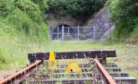
Portals of the Whitrope Tunnel fitted with locked gates by the Forestry Commission.

Locations along the line

These locations are along the line.


This station is closed. The station was opened to the immediate north of the Teviot Viaduct along which its platforms extended.
...
More details
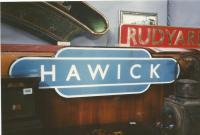
Hawick 30 November 2018. ...
John Yellowlees 06/05/2020
Hawick totem seen at a railwayana auction in 1996. I'll make a wild guess and say that the rest of that nameplate read 'KIPLING'. [Or was from ...
David Panton 07/09/1996
Scottish Grand Tour No 6, headed by Class 47 No 1974, has reached Hawick on 4 January 1969, and the locals are showing what they think of the imminent ...
Colin Kirkwood 04/01/1969
A close up of the Jellicoe Express plaque unveiled at Hawick. The Teviotdale Leisure Centre is on roughly the site of the second (better known) ...
John Yellowlees 30/11/2018
4 of 218 images. more


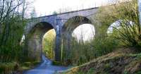
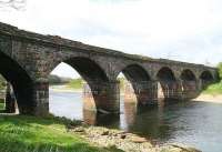
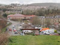
This gently curved six (five?) arch double track viaduct was south of Hawick [2nd] station, the platforms from which extended out over the River Teviot. The platform extensions were in timber, on a metal frame built out from the sides of the viaduct. The viaduct was 42 feet high.
...
More details
A nice seat to sit and wonder if the trains will ever return to Hawick. This view looks northwards from the point where the embankment and Teviot ...
Duncan Ross 18/03/2023
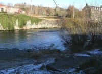
The meagre remains of the railway viaduct that once carried the Waverley route across the River Teviot at Hawick, seen from the south shore on 27 ...
John Furnevel 27/12/2017
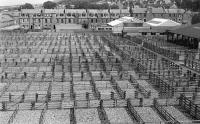
Hawick Auction Mart, seen from the Waverley Route trackbed just south of the Teviot Viaduct in 1975. ...
Bill Roberton //1975
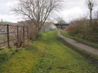
Looking south at the stump of the Waverley Route embankment through Hawick on 18 September 2013. ...
Colin Miller 18/09/2013
4 of 5 images. more


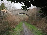
Workshops opened at Loch Park in 1921 to replace the workshops at Riccarton Junction. The works closed in the mid 1960s, before the line closed in 1969.
...
More details
Brougham Place footbridge crosses the Waverley Route in Hawick. This view looks north in March 2023 as my trackbed walk headed towards the centre of ...
Duncan Ross 18/03/2023
Looking towards Hawick on the Waverley Route trackbed in March 2023. This is the point where there is a bridge over Mill Path with the Wellogate Brae ...
Duncan Ross 18/03/2023
This is the old Waverley Route bridge abutment on Lock Park Road in Hawick, seen on 18th March 2023. The steps on the right lead up to the last ...
Duncan Ross 18/03/2023
The Waverley trackbed seen to the south of Hawick station in May 1976. The former Loch Park permanent way siding and workshops are on the right. The ...
Doug Nicholls /05/1976
4 of 23 images. more


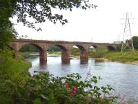
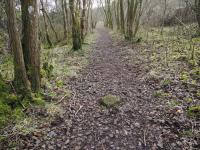
This six arch double track viaduct, also known as Lynnwood Viaduct, was south of Hawick [2nd].
...
More details
The trackbed of the Waverley route south of Hawick is an easy walk from The site of Slitrig Viaduct back towards the town centre. There are a number ...
Duncan Ross 18/03/2023
The Waverley trackbed comes to a sudden stop at the point where Slitrig Viaduct was. Steps now lead down to the B6399 Liddesdale Road. ...
Duncan Ross 18/03/2023
Looking south at the site of Slitrig Viaduct, over Slitrig Water, towards the remains of the Waverley Route trackbed beyond in March 2023. Behind the ...
Duncan Ross 19/03/2023
After accessing the old Borders line via the steps from the B6399 Liddesdale Road I started a walk back into Hawick along the trackbed. I'm assuming ...
Duncan Ross 18/03/2023
4 of 20 images. more


This station was a large terminus with four platforms serving a military training and prisoners of war facility (Stobs Military Camp) near Stobs. There were two island platforms of two faces and a loop for the centre two platform faces. Also known as Stobs Camp Siding.
...

More details

See also
Stobs Military Camp Railway
View west at Stobs on 6 February 2008 over part of the site of the former Stobs Camp (1903-1959). The various remains dotted around the hillsides say ...
John Furnevel 06/02/2008
1 of 1 images.


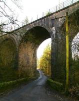
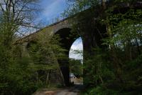
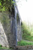
This is a disused double track four arch masonry viaduct just north of the former Stobs station. It is also known as Barns Viaduct or Stobs Viaduct. The overall length is 242 ft.
...
More details
Barnes Viaduct, also known as Stobs or Barns, showing the east side in a view looking north. The former Stobs station is behind the camera. ...
Ewan Crawford 05/05/2014
The unclassified road running west off the B6399 passing through one of the arches of the old railway viaduct at Stobs on the former Waverley route. ...
John Furnevel 06/02/2008
The Barnes (or Stobs) Viaduct looking north showing the west side. This disused viaduct is directly north of the former Stobs station. ...
Ewan Crawford 05/05/2014
The four arches of Stobs Viaduct, photographed from the north east in February 2008. The former station on the Waverley route is now a substantial ...
John Furnevel 06/02/2008
4 of 5 images. more


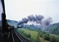
This was a two platform station just to the south of Barns Viaduct. It had a cattle dock on the west side at the north end of the station, approached from the north.
...
More details
Camera lenses all trained on Kingmoor Black 5 45135, working hard on the climb towards Whitrope from the north, seen a little south of Stobs. The shot ...
Robin McGregor 05/06/1965
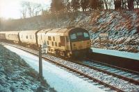
A type 2 takes a train through Stobs station in the mid sixties under a low, harsh winter sun. ...
Bruce McCartney //
Kingmoor Black 5 no 44767 northbound through Stobs on 11 April 1967 hauling BR Hunslet class 05 0-6-0DM shunters D2608, D2617 and D2593. The ...
Bruce McCartney 11/04/1967
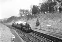
A1 no 60121 Silurian photographed with a Waverley route semi-fast near Stobs in September 1964. ...
Robin Barbour Collection (Courtesy Bruce McCartney) /09/1964
4 of 20 images. more


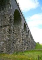
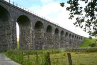
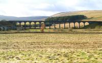
This is an impressive disused double track fifteen arch masonry viaduct to the north of the former Shankend station. The viaduct is 597 ft long and 60 ft high.
...
More details
Opened in 1862, Shankend Viaduct carried the Waverley Route across the Langside Valley, approximately 6 miles south of Hawick. Wide view taken from ...
John Furnevel 06/02/2008
The graceful Shankend Viaduct, located between Riccarton Junction and Stobs on the old Waverley route. View north towards the latter in July 2009 from ...
John Furnevel 10/07/2009
Standing alongside Shankend Viaduct on 10 July 2009 looking north towards Stobs.
...
John Furnevel 10/07/2009
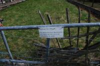
The British Railways Board 'this way is not dedicated to the public' notice on Shankend Viaduct, seen at the north end. ...
Ewan Crawford 05/05/2014
4 of 17 images. more


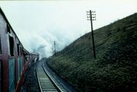
This was a two platform station at the south end of the Shankend Viaduct. It had three looped sidings on its east side, approached from the south end of the station where the signal box was located. The two storey station building, with single storey ticket office at the north end, was on the southbound platform.
...
More details
18 April 1965 and No 60031 'Golden Plover' has passed Shankend on the Waverley Route and is about to reverse onto the up line as a result of ...
Colin Kirkwood 17/04/1965
Shankend looking south station and signal box in the distance. ...
Doug Nicholls /08/1974
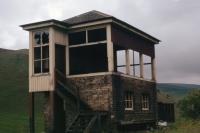
What was left of Shankend signal box in August of 1974, showing the remains of the large windows (see image 24143). The box has since been ...
Doug Nicholls /08/1974
Remains of an old ballast quarry by the White Hill, north of Shankend, on the west side of the Waverley route. When the line was being built it was ...
Ewan Crawford 05/05/2014
4 of 19 images. more


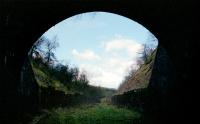
This is a disused twin track tunnel, 1208 yards long. It is the 6th longest railway tunnel in Scotland. It is located between the former Shankend and Riccarton Junction stations on the closed Waverley Route.
...
More details
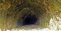
A view looking out of the northern end of a very chilly Whitrope Tunnel in 1998. ...
Ewan Crawford //1998
Track level view looking north towards the fenced off entrance to Whitrope Tunnel in the summer of 2009. Located approximately two and a half miles ...
John Furnevel 10/07/2009
This was the view looking south from the north portal of Whitrope Tunnel in 2014. The tunnel has subsequently been fenced off. ...
Ewan Crawford 05/05/2014
The setting sun enhances this view of the different rock strata in the cutting leading to the North Portal of Whitrope Tunnel north of where the ...
Charlie Niven /11/1993
4 of 15 images. more


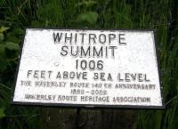
This was a summit of the Border Union Railway (North British Railway) at 970 ft.
...
More details
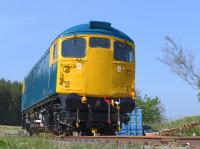
26040 parked at the south end of the Whitrope site. Access with permission. ...
Bill Roberton 04/06/2016
Leyland railbus RB004 at Whitrope shows its complex wiring, in a cupboard behind the central driver's seat see image 54046. All this would ...
Ken Strachan 10/07/2015
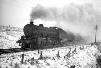
B1 4-6-0 no 61029 Chamois runs through falling snow as it takes a southbound freight over Whitrope summit in the sixties. ...
Robin Barbour Collection (Courtesy Bruce McCartney) //
Summit sign at Whitrope, just south of the tunnel. July 2009. ...
John Furnevel 10/07/2009
4 of 20 images. more


This is a new station built in 2010 and opened on a section of preserved line.
...
More details
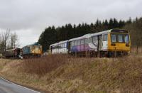
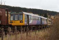
Pacer 142019 moved to Whitrope after retirement from Northern duties. Seen here on 26th February 2023 parked next to longer term resident, pioneer ...
Mark Bartlett 26/02/2023
Scene just south of the Waverley Route Heritage Association centre at Whitrope Siding in the summer of 2009. In the background the trackbed starts to ...
John Furnevel 10/07/2009
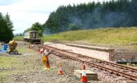
Platform construction underway at Whitrope Siding, headquarters of the Waverley Route Heritage Association, on 10 July 2009. View is south towards ...
John Furnevel 10/07/2009
The elements at Whitrope are taking their toll on the Waverley stock there. 26040 no longer has the pristine look it had on arrival 57267 and the ...
Mark Bartlett 26/02/2023
4 of 33 images. more


This large culvert over the Whitterhope Burn also crossed a road. An enormous amount of material was required for its construction which resulted in its becoming known as the Golden Bridge. Also known as the Whitterhope Culvert. The location is just south of Whitrope Siding.
...

More details


This was an important location in Scottish railway history. This was a large station, junction, locomotive shed, workshops, yard and railway owned village all built at a remote location in the Scottish Borders with no road access. It is a highly evocative location built on the famous former Waverley Route. Here the double track mainline from Edinburgh and Hawick, to the north, split to run ...

More details

See also
Border Counties Railway
The ruinous stationmaster's house at Riccarton as seen in 2012. ...
Ewan Crawford 04/05/2012
The stationmaster's house at Riccarton as seen in 2000. The view looks north with the station site off to the left. ...
Ewan Crawford //2000
The platform at Riccarton, seen partly restored in 2012. The viewpoint is just below the stationmaster's house near where the footbridge crossed over ...
Ewan Crawford 04/05/2012
Riccarton Junction looking north in 1993. This was after the site ceased to be used as a forestry depot but before any restoration. ...
Ewan Crawford //1993
4 of 54 images. more


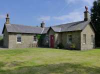
This was a two platform station on the 'The Steele', the southern slopes of Arnton Fell. The small village here was entirely associated with the station. The platforms were in brick with the main station building on the northbound platform.
...
More details
Steele Road station house on 4 June. The platforms were on the far side. On the porch is an inscription N.B.R 1891. Access by kind permission of the ...
Bill Roberton 04/06/2016
Track recovery train near Steele Road station on the Waverley Route in late 1969. ...
Bruce McCartney //1969
A track recovery train passing through Steele Road station in late 1969. ...
Bruce McCartney //1969
Lifting of the Up line at Steele Road had come to a halt several months before this 25th May 1969 shot, looking south. This was the favoured territory ...
Ian Holoran 25/05/1969
4 of 12 images. more


This double track viaduct crossed the Hermitage Water directly upstream of where it joins the Liddel Water, it also crossed the road on the east side of the river.
...

More details


This was a two platform station on the west side of Newcastleton. The main station building, of a single storey, was on the southbound platform.
...
More details
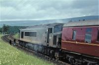
The up 'Waverley' at an unscheduled halt just north of Newcastleton, fire having broken out on the locomotive, Peak D27. Fortunately the train ...
Brian Haslehust 13/06/1964
Newcastleton station and trackbed seen in a view looking south in August 1974. The station buildings and footbridge had been demolished, but the ...
Doug Nicholls /08/1974
On 13th June 1964 the up Waverley drew to an unscheduled halt just north of Newcastleton. From the photo, the train might almost appear to have been ...
Brian Haslehust 13/06/1964
A knight, albeit not quite in the most shining of armour, seen coming to the rescue of Peak D27, which had gone on fire north of Newcastleton ...
Brian Haslehust 13/06/1964
4 of 28 images. more


This was a two platform with timber platforms, small timber shelters and a level crossing at the north end. The single storey station house and offices were on the east side of the station, stone built. Not far to the north was the official Scotland/England Border of the line (two others existed south of Riddings Junction close to Liddel Strength).
...
More details
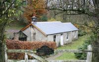
The wayside station at Kershopefoot, Cumbria, lay just south of the Kershope Burn, marking the border between En gland and Scotland. Closed as part ...
John Furnevel 03/11/2007
View north along the trackbed towards what was Kershopefoot level crossing, with the border just beyond. Taken from the station site in November 2007. ...
John Furnevel 03/11/2007
Looking south at Kershopefoot. ...
Ewan Crawford //
A4 Pacific no 60031 Golden Plover photographed near the border at Kershopefoot on 18 April 1965 with the 1X50 BLS Scottish Rambler No 4 ...
K A Gray 18/04/1965
4 of 18 images. more


Weekend only service on a Saturday, only a southbound train. Some timetables still had the halt after 1873 until the 1880s.
...

More details


The dates are assumed. The Railway Clearing House name is Peter's Crook, the name of a farm just to the south west. This quarry, which might be described as Watleyhirst Quarry, was served by a looped siding off the Waverley Route. The loop was on the west side of the line. To the north it connected to the northbound line and to the south to the southbound line. There was a tramway to the quarry, ...

More details


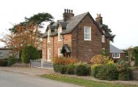
This was a two platform station with a two storey station building on the southbound platform, signal box at the north end of the same platform and a goods yard on the east side, approached from the north.
...
More details
[LIVE] [recno 18007] [Bruce McCartney] [Tuesday 8th of February 2011 08:19:17 AM] Leaving Penton for Kingmoor following the great tomato rescue of ...
Bruce McCartney /08/1967
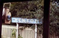
The driveway leading to the remote former station at Penton, Cumbria, in November 2007. Opened in March 1862 between Riddings Junction and ...
John Furnevel 03/11/2007
The RCTS 'Borders Railtour' of 9 July 1961 photographed approaching Penton station on the Waverley Route see image 17983. Carlisle Canal ...
K A Gray 09/07/1961
Mixed signals adorn the gateposts at Penton on 3 November 2007. View is north east along the driveway. ...
John Furnevel 03/11/2007
4 of 7 images. more


This was the junction between the Waverley Route and the branch to Langholm. It was a three platform station, two main line platforms and the main northbound was an island whose second face, on west side of the station, served the branch.
...

More details

See also
Langholm Branch (North British Railway)
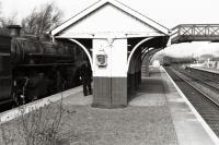
Ivatt class 4MT 2-6-0 no 43139 stands alongside the island platform at Riddings Junction with the Langholm branch train in the spring of 1961. In the ...
David Murray-Smith 16/03/1961
The Last B1 Excursion, behind 61278, heads home in fading light at Riddings Junction in December 1966, with the road clear for the Waverley ...
Bruce McCartney 03/12/1966
View looking south towards Riddings Junction. The former Langholm branch runs off across a viaduct to the right. ...
Ewan Crawford //
Kingmoor based Ivatt class 4 2-6-0 no 43027 stands at Riddings Junction with the Langholm - Carlisle branch train c 1962. ...
Joyce Barker Collection (Courtesy Langholm Archive Group) //1962
4 of 11 images. more


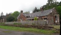
This was a two platform station with a minor level crossing at the north end and a goods yard on the west side, approached from the south. The main station building was on the northbound platform with a small shelter on the southbound.
...
More details
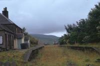
The former station at Scotch Dyke in June 2019. Railway cottages are off to the left. ...
John Yellowlees 01/06/2019
The down platform at Scotch Dyke, Cumbria, in November 2007, looking south along the former Waverley route towards Longtown. The original railway ...
John Furnevel 03/11/2007
Scotch Dyke station, seen during an outing of the North British Railway Study Group on 1st June 2019. The 'Speed and Comfort By Rail' legend is ...
Bill Roberton 01/06/2019
What ought to have been the final Langholm bound freight, photographed at Scotch Dyke in August 1967.
...
Bruce McCartney /08/1967
4 of 8 images. more


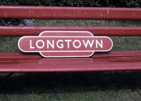
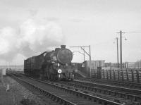
This was a two platform station. The two storey main station building was on the southbound platform. To the immediate north of this was a staff bothy and a large water tank. To the south, over a level crossing, was Longtown Branch Junction where the routes to Carlisle and Gretna [NBR] divided. To the north was a goods yard on the east side and locomotive shed on the west side.
...
More details
Total cost - thirty bob (including delivery to Hawick by BR van). ...
Bruce McCartney //
A B1 with a short freight heads south on the Waverley route on the approach to Longtown in the 1960s. ...
K A Gray //
View from the southbound Scottish Grand Tour about to pass through Longtown station on 4 January 1969. [Ref query 6622] ...
D Walker Collection [Courtesy Bruce McCartney] 04/01/1969
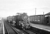
Ivatt class 4 2-6-0 no 43027 draws into Longtown with the Langholm - Carlisle branch train around 1962. ...
K A Gray //1962
4 of 11 images. more


This was a two platform station just west of the small village of Westlinton in Cumbria, England. There was a level crossing to the south and a goods yard to the north on the east side of the line.
...

More details
The former station house at Lyneside, closed to passengers in 1929, seen during a North British Railway Study Group visit on 1st June 2019 with access ...
Bill Roberton 01/06/2019
Midway between Carlisle and Riddings Junction, the Waverley Route passed through the wayside station of Lyneside, serving the small Cumbrian village ...
John Furnevel 03/11/2007
The base of the former signalbox at Lyneside. Seen on an NBRSG outing on the 1st of June. ...
Bill Roberton 01/06/2019
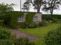
The lower portion of the former signal box at Lyneside survives as a garden shed at the site of the station. ...
John Yellowlees 01/06/2019
4 of 12 images. more


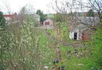
This was a two platform station. There was a goods yard to the north, on the east side of the line. The main station building was on the southbound platform.
...
More details
View north at Harker in 1998 showing the station site, building, platform and one of the few remaining signal boxes on the former Waverley Route. [Ref ...
Ewan Crawford //1998
1 of 1 images.


This private halt had two platforms. It was built in 1941 to serve Carlisle RAF Maintenance Unit (14MU), just to the west. The RAF depot was expanded to cover a considerable area. The halt was named for Park House, just to the west.
...
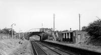
More details
Parkhouse Halt station in July 1969. Situated just north of Carlisle on the Waverley Route it opened in 1941 to serve Carlisle RAF Maintenance Unit ...
John Clark /07/1969
1 of 1 images.


The compound at Brunthill Siding. ...
John Yellowlees 01/06/2019
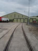
Trackwork inside the Carlisle Warehousing site at Brunthill Sidings, Carlisle as seen on 14 September 2021. Access courtesy of Royal Mail staff on ...
David Pesterfield 14/09/2021
View north along Kingmoor Road on 4 June 2021 showing the rustic surroundings enclosing the rail bridge for the rarely used single track branch line ...
David Pesterfield 04/06/2021
Trackwork inside the Carlisle Warehousing site at Brunthill Sidings, Carlisle as seen on 14 September 2021. Access courtesy of Royal Mail staff on ...
David Pesterfield 14/09/2021
4 of 12 images. more


A 1965 photograph of V2 60844 setting off on the Waverley Route with a northbound freight. The train is crossing the bridge over the West Coast main ...
Robin McGregor 06/08/1965
Stainton Junction looking north. The line to the left runs to the Kingmoor Yard, the other line being the former Waverley Route. The latter line ...
Ewan Crawford //
An Ivatt class 4 about to cross the bridge over the WCML at the south end of Kingmoor Yard with a down freight on the Waverley route, thought to be in ...
Robin Barbour Collection (Courtesy Bruce McCartney) //1966
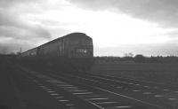
Brush Type 4 no 1536 photographed in fading winter light at Stainton crossing on 28 Deccember 1968 with the 8.50am from St Pancras (3.58pm ...
K A Gray 28/12/1968
4 of 14 images. more


The bridge that once carried the Waverley route north over the River Eden, photographed looking west in April 2007. Carlisle Canal shed stood off to ...
John Furnevel 18/04/2007
The grade 2 listed Waverley Viaduct that carried the Border Union Railway over the River Eden at Carlisle (also referred to as Eden Viaduct, Canal ...
Colin Alexander 03/08/2011
2 of 2 images.


This single ended shed was in the 'V' of the junction between the Border Union Railway and the Silloth branch. It was served from the east, from Canal Junction, splitting off the Border Union just after the junction.
...
More details
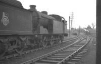
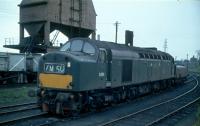
Must be a freight duty ahead for EE Type 4 D394 as it passes by Carlisle Canal shed with a brake tender in tow on 28 April 1963.
...
Colin Kirkwood 28/04/1963
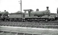
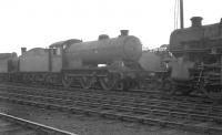
J36 no 65312 photographed on Carlisle Canal shed in the summer of 1962. Having spent the entire BR period based at Canal, the 0-6-0 was finally ...
John Robin 24/06/1962
Part of the shed yard at Carlisle Canal in 1960, with an A3 Pacific manoeuvering in the background. ...
K A Gray //1960
Locomotives in the shed yard at Carlisle Canal on 12 April 1963. Centre stage is Gresley J39 0-6-0 no 64899, a resident here throughout the BR period. ...
K A Gray 12/04/1963
4 of 31 images. more