Devon Valley Railway
Introduction
This railway is closed. The line extended the Tillicoultry branch to Kinross, a single track line following a fairly tortured route by the River Devon. It completed, for the North British Railway, a route between Glasgow and Perth. It could never compete with the main line through Dunblane which has survived it.


Dates
| / /1858 | Devon Valley Railway Act receives Royal ascent |
| 04/08/1860 | Devon Valley Railway First sod cut. |
| 01/05/1863 | Devon Valley Railway Opened from Hopefield to Rumbling Bridge (worked by North British Railway). |
| 30/07/1866 | Devon Valley Railway Blairenbathie and Blairadam Collieries Branch (North British Railway) Devon Valley Railway Act gives permission for a branch from Rumbling Bridge [1st] to Wattie's Ford Bridge and an extension from there to Kelty on the Kinross-shire Railway, much of what was later used for the Blairenbathie and Blairadam Collieries Branch (North British Railway). Another branch to Newhall near Solsgirth also approved. Branches not built. |
| 01/10/1868 | Devon Valley Railway Closed from Rumbling Bridge [1st] to Crook of Devon (excluded) to allow realignment. The approach to a new Rumbling Bridge station was lowered in a quarter mile cutting. (An alteration suggested by the North British Railway engineer to east the gradient on approach to Rumbling Bridge from the west.) |
| 01/05/1869 | Devon Valley Railway Dollar station opened |
| 03/05/1869 | Devon Valley Railway Opened from Tillicoultry to Dollar. |
| 01/10/1870 | Devon Valley Railway Re-opened from Rumbling Bridge [2nd] to Crook of Devon. |
| 01/05/1871 | Devon Valley Railway Opened from Dollar to Rumbling Bridge [2nd]. |
| / /1875 | Devon Valley RailwayNorth British Railway Devon Valley Railway absorbed by North British Railway. |
| / /1956 | Dollar Colliery No 4 Dollar Colliery No 5 Constructed at Wester Pitgober, connected to the Devon Valley Railway. |
| 13/06/1964 | Devon Valley Railway Kinross Junction to Alloa East Junction closed to passengers. |
| 15/06/1964 | Devon Valley Railway Kinross Junction (excluded) to Dollar (excluded) closed to freight. |
| / /1973 | Devon Valley Railway Stirling and Dunfermline Railway Dollar Mine to Alloa Co-op Coal Siding (excluded) closed. |
| 23/06/1973 | Devon Valley Railway Dollar to Alloa Co-op Coal Siding (excluded) closed to freight on closure of Dollar Colliery No 4 and Dollar Colliery No 5. |
| 25/08/1973 | Stirling and Dunfermline Railway Devon Valley Railway Final train to Dollar, the Branch Line Society's Stirling and Dunfermline Railtour. |
Portions of line and locations
This line is divided into a number of portions.
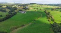
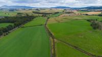
Tillicoultry to Kinross
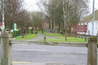
This station was originally a terminus and later a through station. It was located on the west side of a level crossing over Moss Road to the south of Tillicoultry. It was rebuilt at least three times.
...
See also
Stirling and Dunfermline Railway
Tillicoultry 1,2 Colliery Line (Alloa Coal Company)
John McIntyre 25/11/2018
John Furnevel 06/03/2008
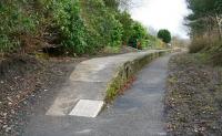
This was a single platform station, the platform being on the north side.
...
Mark Bartlett 05/08/2022
Ewan Crawford 17/08/2023
Mark Bartlett 05/08/2022
John Furnevel 06/03/2008
This coal mine was located east of Dollar station. The branch to the mine ran from the loop at the east end of the station.
...
Ewan Crawford 17/08/2023
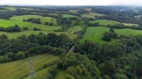
This was a six span single track girder viaduct crossing the River Devon south east of Dollar carrying the Devon Valley Railway east to Kinross. The viaduct, on a gentle curve, was 390ft long and 53ft high with spans between 45ft and 55ft long. The viaduct approaching the viaduct from the station became increasingly tall before the line crossed over the Devon to high ground on the south ...
More details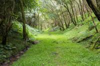
Ewan Crawford 17/08/2023
Ewan Crawford 17/08/2023
Ewan Crawford 17/08/2023
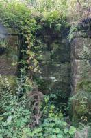
Also known as Blashie or Balshie. This short siding was on the south side of the line, approached from the west, and had a loading bank. A lane ran south west to Dollarbeg. Nearby was Melloch Colliery.
...
Ewan Crawford 17/08/2023
Ewan Crawford 17/08/2023
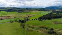
A station was proposed for Blairingone and had considerable local support. In the area south of the line were freestone, ironstone and coal reserves. A siding was laid in, which allowed departure in both directions, on the south side of the line. From this a tramway ran south to the Blairingone Colliery. This coal work began with the opening of the Devon Valley Railway.
...
Ewan Crawford 17/08/2023
Ewan Crawford 17/08/2023
Ewan Crawford 17/08/2023
Brian Forbes 28/10/2007
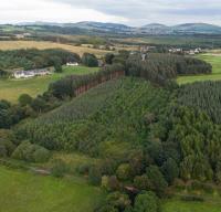
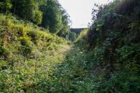
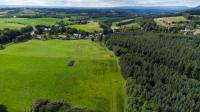
This is an 80ft deep cutting through sand, about 900ft long. Construction of the cutting caused the contactor considerable difficulty. 180,000 cubic yards of sand were removed and the cutting slopes had slippage several times during construction. High stone built retaining walls at the bottom of the cutting down either side, with refuges for surfacemen.
...
Ewan Crawford 17/08/2023
Ewan Crawford 17/08/2023
Ewan Crawford 17/08/2023
Ewan Crawford 17/08/2023
This siding was on the north side of the Devon Valley Railway and approached from the west. There was a stone built loading bank. From this loading bank a tramway ran first west, then (on a tight curve) pass south under the railway before climbing to Devonshaw Quarry at Gibson's Craig, just over half a mile to the south.
...
Ewan Crawford 17/08/2023
Ewan Crawford 17/08/2023
Ewan Crawford 17/08/2023
Ewan Crawford 17/08/2023
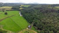
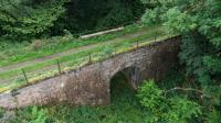
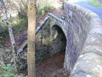
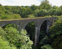
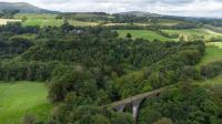
This is a disused six arch single track arched stone viaduct over the Gairney Burn, a tributary of the River Devon. The viaduct is 360ft long and 110ft tall with arches of 45ft. The Gairney is in a deep ravine resulting in very tall piers. The viaduct is a mile south west of the former Rumbling Bridge [2nd] station and just east of Devonshaw Siding.
...
Ewan Crawford 17/08/2023
Ewan Crawford 17/08/2023
This was a two platform station with a passing loop on a single track railway. Platforms were staggered. The eastbound platform was slightly further to the north. This platform had the main station building.
...
Ewan Crawford 17/08/2023
Ewan Crawford 17/08/2023
Ewan Crawford 12/09/2023
John Furnevel 23/10/2007
This was the temporary terminus of the line from Kinross [1st] before its extension west to Dollar. The station was at surface level which would result in a very steep gradient to the west if the original proposed line was built. The North British Railway saw the line as an important through route and its engineer proposed an alteration. The line was closed west of Crook of Devon ...
More details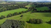
Ewan Crawford 30/08/2023
Ewan Crawford 30/08/2023
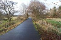
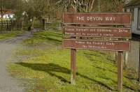
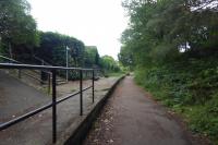
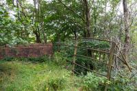
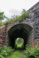
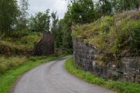
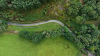
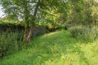
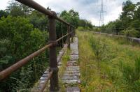
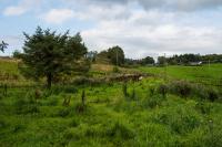
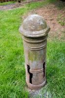
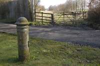
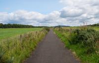
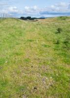
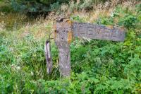
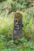
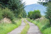
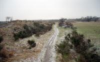
This level crossing was west of Crook of Devon station where minor roads to Harelaw and Keith-hills crossed the line. A single large cast iron post by Harper & Co's Craiginches Iron Works remains here. With a short diversion towards the church the trackbed can be followed here today eastwards to the station.
...
Ewan Crawford 30/08/2023
Ewan Crawford 30/08/2023
Bill Roberton 19/03/2009
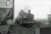
Frank Spaven Collection (Courtesy David Spaven) /06/1964
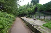
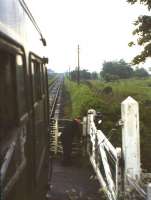
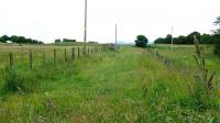
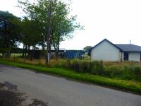
This was a single platform station on the north side of a single track line. To the west was a goods yard on the north side of the line, approached from the west. The station was to the west of a level crossing south east of Crook of Devon itself.
...
Ewan Crawford 30/08/2023
Ewan Crawford //1996
Ewan Crawford 30/08/2023
Ewan Crawford 30/08/2023
This level crossing was east of Crook of Devon station. There was a gate keeper's cottage on the north side of the line, west side of the minor road.
...
Ewan Crawford 30/08/2023
Ewan Crawford 30/08/2023
Ewan Crawford 30/08/2023
Ewan Crawford 30/08/2023
This level crossing was located between Crook of Devon and Balado. There was a gate box on the south side of the line and west side of the road and a gate keeper's cottage.
...
Ewan Crawford 30/08/2023
Ewan Crawford 30/08/2023
Ewan Crawford 30/08/2023
Brian Forbes 13/07/2008
This was a single platform station on a single track railway. There was a goods dock at the east end and sidings, with a goods shed, on the south side. The station building was a small neat stone built cottage on the platform. There was no signal box, but a covered ground frame on the platform by the level crossing.
...
Ewan Crawford 30/08/2023
Ewan Crawford 30/08/2023
Mark Bartlett 04/08/2022
This was the junction between the Fife and Kinross Railway and Devon Valley Railway. Between 1860 and 1890 it was the site of a station initially known as Hopefield and, after the opening of the DVR, Kinross Junction [1st]. The station was relocated to the north as Kinross Junction [2nd] in 1890.
...
This station replaced Kinross [1st] when the Fife and Kinross Railway met the Kinross-shire Railway at Loch Leven, Kinross [3rd].
...
See also
Fife and Kinross Railway
Ewan Crawford 30/08/2023
Ewan Crawford //1996