Slamannan Railway
Introduction
This 12 mile long railway is closed. It was an extension of the Ballochney Railway's Whiterigg and Arbuckle branch at Airdriehill to further mining districts to the east. Initially called the Arbuckle Railway the line was extended further east ultimately reaching the Union Canal basin at Causewayend [SR], a total length of 14.25 miles.
Dates
Portions of line and locations
This line is divided into a number of portions.
Arbuckle to Slamannan and Causewayend
This junction, also known as Arden Junction, was the junction between the Ballochney Railway (of 1828) and the Slamannan Railway (opened 1840). Here the Slamannan joined a mineral branch dating from 1830 of the Ballochney which ran from Whiterigg to Arden to serve various pits - the Whiterigg, Stanrigg, Arbuckle, Arden Branch (Ballochney Railway).
...
See also
Whiterigg, Stanrigg, Arbuckle, Arden Branch (Ballochney Railway)
This station was located at the junction between the Slamannan Railway and the Arden or Arbuckle branch of the Ballochney Railway. It was just east of the junction on the Slamannan. There appears to have been a platform on the south side of the line.
...
Also spelled Standrig.
...
This pit was at the point where a short branch left the Slamannan Railway and ran east, south of the line, to serve Kimberley Coal Pit and Arden Colliery Pits Nos 8 and 10. ...
More detailsThis pit was on a branch from the Slamannan Railway which ran parallel with the line from a junction to the west. Thompson's Hope Coal Pit No 3 and Arden Colliery Pits Nos 8 and 10. ...
More detailsThis was initially a siding approached from the west and on the north side of the line. Also known as Moss Lye Siding (that name being a tautology, a Lye being a Siding), Mosslye Siding or Moss Tank. The water tank here was important as line climbed from both west and east to reach the summit of the line.
...
See also
Longriggend and Limerigg Colliery Railway
This was a one platform station on a single track line. The platform was on the north side of the line to the east of a road overbridge.
...
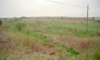
Ewan Crawford 03/05/1997
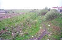
Ewan Crawford 03/05/1997
This signal box was at the west end of a loop which ran east to North Monkland Junction. There were a considerable number of mineral lines in the area. The box was on the north side of the loop. This loop was one of many sections of the Slamannan Railway doubled. The line was on, approximately, a south west to north east alignment.
...
This was the junction between the Slamannan Railway of 1840 and the North Monkland Railway of 1878, a partly independent line of North British Railway origins.
...
See also
North Monkland Railway
This station was about half a mile south of the village of Slamannan. In its final form [3rd] the passenger station and goods station were to the west of a level crossing, with Station Road. The single passenger platform was on the north side of the line with timber station building in North British Railway style. To the north of the passenger station was the goods yard, approached via a ...
More details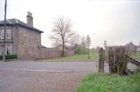
Ewan Crawford 03/05/1997
This was the junction for the Strathavon Branch (Slamannan Railway) which ran north west to Strathavon Colliery, was extended on to Jawcraig Colliery and beyond that as a private line to iron ore pits at Garbethill.
...
See also
Strathavon Branch (Slamannan Railway)
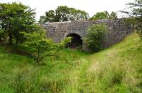
Douglas Blades 26/07/2019
This was a short lived halt between Slamannan station, to the west, and Avonbridge, to the east. The station not open with the line in 1840, it probably dated from around 1848. It closed in 1850 (some sources suggest 1849).
...
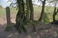
Ewan Crawford //2000
This was a single platform station on the south side of the line and west of a level crossing.
...
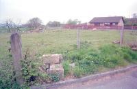
Ewan Crawford 03/05/1997
This was a station, junction and yard. The station consisted of a single platform on the south side of the line. The alternative spelling Blackstone was used in some timetables at varying dates.
...
See also
Torbanehill and Bathgate Branch (Monkland Railways)
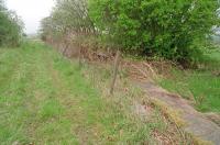
Ewan Crawford 03/05/1997
This was a single platform station with three sidings. The platform was on the east side and built in timber. There was a stone built loading bank. The goods shed was in the yard, but not rail served.
...
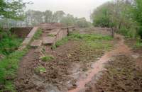
Ewan Crawford 03/05/1997
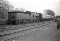
Robin Barbour Collection (Courtesy Bruce McCartney) 07/05/1960
The incline top was half a mile west of Causewayend.
...
An engine house was located at the top of the Causewayend Incline which ran uphill westwards from Causewayend Basin to Causewayend Incline Top, a distance of around half a mile.
...
Causewayend Incline Foot signal box was located here, closed in 1930 when the line closed to passengers. The box was to the south of the basin sidings and north of the Manuel low level line.
...
See also
Slamannan and Borrowstounness Railway
Slamannan Junction Railway
This was the eastern terminus of the Slamannan Railway at Causewayend Basin on the Union Canal. Coal for Edinburgh, and passengers, could continue along the canal. After just two years the route lost its advantage when the Edinburgh and Glasgow Railway opened in 1842.
...
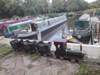
John Yellowlees 16/09/2021
Roughrigg Branch
Avonhead Branch
This pit was served by a line from the east which ran to the Slamannan Railway. ...
More details
Southfield Branch


