Forth and Clyde Junction Railway
Introduction
This railway ran between Stirling and Balloch and is closed. The promoters hoped to create a great west coast to east coast trunk line. It was promoted in Stirling with the hope to export Fife coal along the line, there being no Clyde harbour on the Edinburgh and Glasgow Railway.
Passing through an area largely rural area of farming with little industry it didn't achieve their ambitions. A portion of it was used by the Strathendrick and Aberfoyle Railway's route.
It closed to passengers in 1934. The line was a useful diversionary route in war time and was used by returning soldiers in the Second World War.
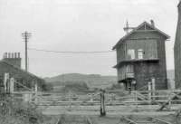
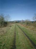
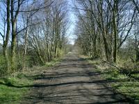
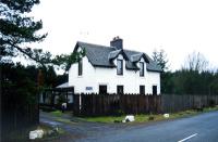
It was closed progressively in portions. No part remains open today although the Drymen Viaduct and Jamestown Viaduct [Balloch] remain as its greatest monuments. The signal box at Kippen, though in poor shape, is a superb survivor.
Architecture
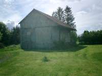
The design of goods shed used on this line was later used on the Inverness and Perth Junction Railway, becoming the standard design for the Highland Railway.
Dates
Portions of line and locations
This line is divided into a number of portions.
Balloch to Stirling
This was a double track junction between the existing Caledonian and Dumbartonshire Junction Railway of 1850 and the later Forth and Clyde Junction Railway of 1856. The junction was south of Balloch Central and today's Balloch station.
...
See also
Caledonian and Dumbartonshire Junction Railway
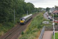
John McIntyre 01/09/2018
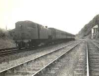
G H Robin collection by courtesy of the Mitchell Library, Glasgow 09/07/1957
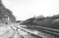
G H Robin collection by courtesy of the Mitchell Library, Glasgow 09/07/1957
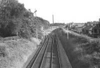
G H Robin collection by courtesy of the Mitchell Library, Glasgow 09/07/1957
This long siding served the Croftengea Works. It was a branch of the Forth and Clyde Junction Railway leaving that line just east of Forth and Clyde Junction at Balloch.
...
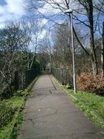
Alistair MacKenzie 20/03/2007
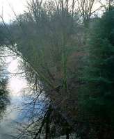
Alistair MacKenzie 19/12/2007
This is a disused 296 ft long single track 3 span girder viaduct over the River Leven. Levenbank Print Works and Jamestown station was a short distance to the east and Croftengea Siding a little to the west.
...
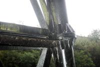
Ewan Crawford 03/10/2004
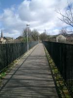
Alistair MacKenzie 20/03/2007
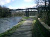
Alistair MacKenzie 20/03/2007
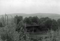
John Robin 08/07/1963
This was a large print works opened by Watson, Arthur and Co on the east bank of the River Leven at Jamestown, just south of Balloch. (Also known as Levenbank Dye Works.) The print works was served by sidings from the Forth and Clyde Junction Railway in the extreme south of the site. Approach to these sidings, on the north side of the line, was from the west, over the [[Jamestown ...
More detailsThis was a two platform station on the west bank of the River Leven near Balloch.
...
Alistair MacKenzie //2004
Ewan Crawford //
This siding was a loading point on the Forth and Clyde Junction Railway and Auchencarroch Quarry (to the south). A looped siding was on the south side of the line, approached from the east.
...
Alistair MacKenzie 03/04/2007
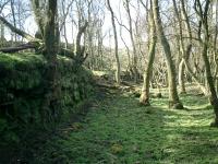
Alistair MacKenzie 03/04/2007
This was a single platform station on the single track line. Station buildings were modest, a small timber shelter with single sloping roof supplemented by a grounded wagon body.
...
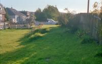
Ewan Crawford //1988
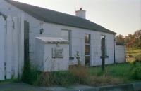
Ewan Crawford //1988
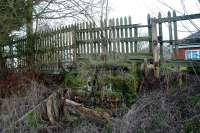
Ewan Crawford //2003
This siding, on the south side of the line, was north east of Caldarvan station, at the distant signal for the station. The siding was built for a Dunbartonshire County Council owned tip in 1901. Gallangad Farm is to the south.
...
Finnery (or Finnary) siding was west of Mavie Mill Crossing. The siding was on the north side of the line and approached from the west. This siding was opened in 1858, served Balquhain Quarry which provided stone for the Loch Katrine water supply scheme. It closed shortly afterwards.
...
Mavie Mill Crossing was a signalled (with home and distant signals) level crossing between Caldarvan and Drymen stations.
...
Cattermuir Mill Crossing was a signalled (with home and distant signals) level crossing between Caldarvan and Drymen stations.
...
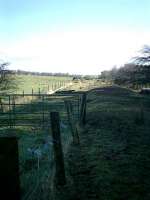
Alistair MacKenzie 22/03/2007
This was a two platform station with a passing loop. The main stone build station building was on the eastbound platform.
...
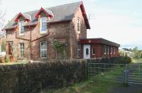
John Furnevel 11/10/2007
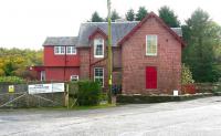
John Furnevel 11/10/2007
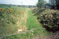
Ewan Crawford 08/05/1987
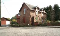
John Furnevel 11/10/2007
This was a 320ft single track four span girder viaduct just east of Drymen station carrying the railway over the Endrick Water. (From the west - a girder span, inverted bowstring span, and two girder spans.)
...
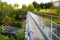
John Furnevel 11/10/2007

Ewan Crawford 26/07/2021
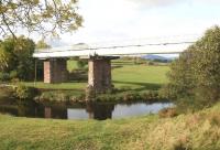
John Furnevel 11/10/2007
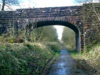
Alistair MacKenzie 22/03/2007
This was a 120 ft single track tressle viaduct crossing over boggy ground and the Altquhur Burn. It was located between Drymen Viaduct and Gartness station. Also known as Altquhur Viaduct. The viaduct was replaced with an embankment and culvert by the North British Railway around 1875.
...

Ewan Crawford 26/07/2021
This was a single platform station with single siding at the east end. At the west end was a level crossing. East of the station was Gartness Junction where the Forth and Clyde Junction Railway was met by the Strathendrick and Aberfoyle Railway which used its metals to reach Buchlyvie Junction where it branched off for Aberfoyle.
...
Ewan Crawford //1995
Alistair MacKenzie 03/05/2007
Bill Roberton //1986
Alistair MacKenzie 03/05/2007
Here the Forth and Clyde Junction Railway was met by the Strathendrick and Aberfoyle Railway which used its metals to reach Buchlyvie Junction where it branched off for Aberfoyle.
...
See also
Strathendrick and Aberfoyle Railway
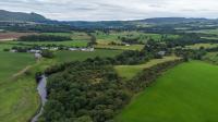
Ewan Crawford 09/08/2023
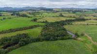
Ewan Crawford 09/08/2023
Ewan Crawford 26/07/2021
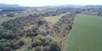
Ewan Crawford 26/07/2021
This tile works was south west of Balfron station. The works was on the south side of the line and served by a siding, also on the south side, which was approached from the south west. There was a short tramway within the works.
...
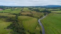
Ewan Crawford 09/08/2023
This was a two platform station with station buildings and signal box typical of the line. There was a passing loop. To the south was a level crossing which was crossed by the loop. The main station building was on the Stirling bound platform, with a waiting shelter on the other. The signal box (added 1893) was on the Balloch bound platform next to the level crossing. There was a goods ...
More details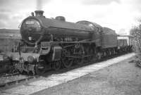
John Robin //1958
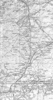
Alistair MacKenzie //1924
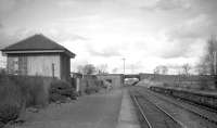
John Robin //1958
This was a signalled level crossing with home and distance signals. A crossing keeper's cottage was on the east side of the line.
...
This farm siding was on the south side of the line and approached from the east over a level crossing. There was a railway cottage to the south of the crossing. It was located between Balfron and Buchlyvie stations.
...
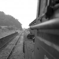
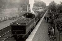
This was a two platform station. It was a station with a passing loop on a single track line. The station house was on the westbound platform. A box opened in 1892 along with the loop and second platform.
...
John Robin //1958
G H Robin collection by courtesy of the Mitchell Library, Glasgow 18/09/1951
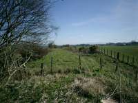
This was the junction between the older Balloch to Stirling line and the Aberfoyle branch of 1882. It was located at the east end of Buchlyvie station's loop.
...
See also
Strathendrick and Aberfoyle Railway
Alistair MacKenzie 04/04/2007

Ewan Crawford 15/10/2018
This railway ballast pit was east of Buchlyvie Junction. It was located on the north side of the line and approached from the east. It closed at an early date.
...
This was a farm siding. It was located on the north side of the line and approached from the east. There was a railway cottage, Mye Cottage, to the immediate west on the north side of the line alongside a level crossing to its west. The crossing appears to have had a single signal post.
...
This was a level crossing on a very minor road to Knockinshannock. There was a gatekeeper's cottage on the north side of the line, west of the road.
...
This was a level crossing with the minor road to Blackhouse. There was a crossing keeper's cottage on the south side of the line, east of the road. The distant signal for Port of Menteith station, to the east, was a short distance east.
...
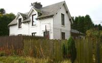
Port of Menteith was briefly known as Cardross and was renamed to avoid confusion with the Glasgow, Dumbarton and Helensburgh Railway's station when it opened in 1858.
...
John Furnevel 11/10/2007
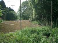
Alistair MacKenzie 25/05/2007
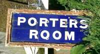
Alistair MacKenzie 25/05/2007
This was a farm siding and passenger halt. The siding was on the north side of the line, approached from the west. It was just east of a level crossing. There was a railway cottage on the north side of the line at the crossing. The crossing was not signalled.
...
This was a farm siding and, between 1861 and 1866, a halt. The siding was on the north side of the line and approached from the west. There was a level crossing to the east. The crossing was equipped with home and distant signals. There was a cottage on the south side of the line, east of the crossing. Fairfield Farm is just to the north.
...
There was a level crossing with a railway cottage on the south side of the line, west of the road. The cottage still stands as a house, The Gatehouse.
...
This was a level crossing on an access road to Little Kerse. There was a crossing keeper's cottage on the north side of the line, east of the road.
...
This was a level crossing on an access road to Little Kerse. There was a crossing keeper's cottage on the north side of the line, west of the road.
...
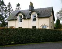
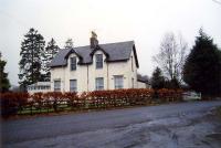
This was a two platform station. The station was to the west of a level crossing and the station building, goods shed, loading bank and, notably, the signal box (dating from 1893, last of its type and 'B' listed) still stand. The station building stands on what was the westbound platform, the signal box is by the level crossing.
...
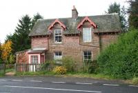
John Furnevel 11/10/2007
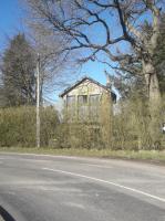
John Yellowlees 15/04/2023
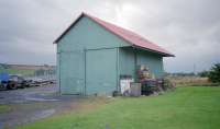
Ewan Crawford //1987
Level crossing with the minor road north to Fordhead. There was a crossing keeper's cottage on the south side of the line, west of the road.
...
Level crossing with the minor road north to Wester and Easter Culmore. There was a crossing keeper's cottage on the north side of the line, west of the road.
...
This was a level crossing with the access road to Culbeg, to the north. There crossing keeper's cottage remains here in use as a house. It was on the north side of the line, west of the road.
...
This was a level crossing with a gatekeeper's cottage, now gone, on the north side of the line, west of the road. Some time after the cottage's removal a new house was built in a slightly different location.
...
This level crossing was for the access road to Kepdarroch, to the north. There was a gatekeeper's cottage on the north side of the line, east of the road. This is a house and has been rebuilt.
...
The station is largely eradicated. Some portions of the eastbound timber platform remain by the A811 road. There was a level crossing between the passenger station (to the east) and goods station (west). The loop extended from the one to the other, crossing the level crossing. The box was on the west side of the crossing, south side of the line. It had opened in 1892. There was no crossing loop ...
More details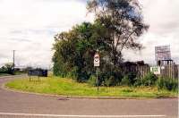
Ewan Crawford //2003
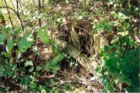
Ewan Crawford //2003
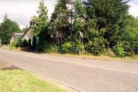
Ewan Crawford //2003
This level crossing was with the access road to Shaw of Touch, to the north. There is a crossing keeper's cottage, now a private house, on the north side of the line, east of the crossing.
...
This siding was for the Murrayshall Lime Kilns which provided agricultural lime to the area. A standard gauge tramway linked the siding to the works. The siding was on the south side of the line.
...
This level crossing was between North Kersebonny and South Kersebonny. There was a crossing keeper's cottage on the north side of the line, east of the crossing.
...
This level crossing was with Raploch Road. There was a gate box on the south side of the line, east of the crossing. It operated the signals (home and distant). (There was a further level crossing to the east at Glendevon Drive.)
...

Colin McDonald 20/08/2020
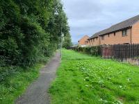
Colin McDonald 20/08/2020
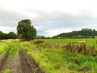
Colin McDonald 20/08/2020
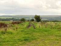
Colin McDonald 20/08/2020
The siding was on the south side of the line, approached from the west.
...
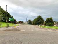
Colin McDonald 20/08/2020
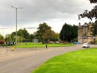
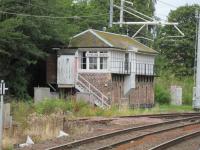
This signal box controlled a level crossing with a road and tramway and the approach into Stirling station for the Forth and Clyde Junction Railway.
...
Colin McDonald 20/08/2020
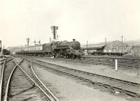
This was the shed of the Forth and Clyde Junction Railway, built in the 'V' of the junction between that line and the Scottish Central Railway. It was considered part of Shore Road Shed [NB], although geographically remote from it being across the SCR from the Stirling and Dunfermline Railway shed.
...
This coal depot was north of Stirling station. It was approached from the south by reversing from the Forth and Clyde Junction Railway's Cowpark Goods. The yard was on the west side of that line, across it from Stirling Shed [NB].
...
This goods yard, also known as Cowpark (or Cow Park) Siding, was north of Stirling station on the east side of Stirling's Auction Market at its many cattle pens.
...
This junction was just north of Stirling station and was formed when the 1848 Scottish Central Railway was met by the 1856 Forth and Clyde Junction Railway.
...
See also
Scottish Central Railway
Croftengea Branch
This branch, which started close to the western end of the line, ran to the Croftengea Works.
This long siding served the Croftengea Works. It was a branch of the Forth and Clyde Junction Railway leaving that line just east of Forth and Clyde Junction at Balloch.
...

Alistair MacKenzie 20/03/2007

Alistair MacKenzie 19/12/2007
This bleach and print works was opened by John Todd & Co. It was later owned by Sir Archibald Orr Ewing, one of the promoters of the Forth and Clyde Junction Railway, along with the Milton Works (Dyeing), Levenbank Print Works and Dillichip Dye Works which were also in the Vale of Leven.
...
Dalmonach Branch
This was a short goods line from Jamestown to the Dalmonach Print Works.
This was a two platform station on the west bank of the River Leven near Balloch.
...

Alistair MacKenzie //2004

Ewan Crawford //
This dyeing works was on the east bank of the River Leven. It was opened by Todd & Shortridge Co in 1772. From 1863 it was served by a branch of the Forth and Clyde Junction Railway which ran south from Jamestown station and also served the Dalmonach Print Works.
...
This dyeing works was on the east bank of the River Leven. It was opened by Todd & Shortridge Co in 1772. From 1863 it was served by a branch of the Forth and Clyde Junction Railway which ran south from Jamestown station and also served the Dalmonach Print Works.
...
This print works bordered the east bank of the River Leven, just north of the Bonhill Bridge.
...
Ewan Crawford 24/06/2006
Stirling connecting line
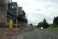
A short connecting line was built from Stirling North Junction to the Stirling and Dunfermline Railway, connecting together the Forth and Clyde Junction Railway to the rest of the North British Railway system.
This junction is to the north of Stirling station. The junction is between lines north to Perth and east to Alloa.
...
See also
Scottish Central Railway
David Panton 21/08/2019
G H Robin collection by courtesy of the Mitchell Library, Glasgow 23/05/1959
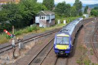
Bill Roberton 25/08/2017
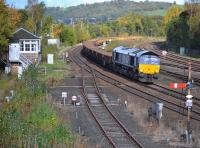
Bill Roberton 22/10/2017
This level crossing was to the north of Sitrling East station, the Stirling and Dunfermline Railway and later North British Railway station. It was controlled by a signal box, Shore Road Level Crossing Signal Box, which was opened in 1887. This was on the west side of the line and south of the level crossing. Just to the west was the equivalent Shore Road Level Crossing [CR].
...
See also
Stirling and Dunfermline Railway
Books
 The Railways of Stirling |  The Vanished Railways of Old Western Dunbartonshire (Britains Railways/Old Photos) |


