Lanarkshire and Dumbartonshire Railway

Introduction

This line is closed except for a short section in Dumbarton from Dumbarton East Junction to Dunglass Junction [West] and another short, but disused, section between Dalmuir Riverside and Clydebank. The line was a protege of the Caledonian Railway.

Why built

This line connected the Caledonian Railway's system to shipyards, docks and factories on the north bank of the River Clyde. More than that, it encouraged the development of many of these works. It was built to compete with the existing North British Railway's system. It also carried passenger services from Glasgow to Possil and Dumbarton and connected with the line to Balloch.


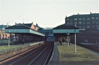
As the line was built to compete with the existing network of the North British Railway, stations were built to a good standard with large station buildings with platform canopies.

Service

Passenger services ran from Glasgow Central Low Level to Possil and from Glasgow Central Low Level to Dumbarton Central, many continuing to Balloch Central.


Dates

  /  /1890Lanarkshire and Dumbartonshire Railway
Company arranges a working agreement with the Caledonian Railway.
  /  /1891Lanarkshire and Dumbartonshire Railway
Lanarkshire and Dumbartonshire Railway authorised. Working agreement with the Caledonian Railway confirmed.
  /  /1891Lanarkshire and Dumbartonshire Railway
Bellshaugh Junction (Glasgow Central Railway) to Maryhill Junction (Glasgow Central Railway) authorised, (which would complete a freight route in the north of Glasgow).
  /  /1892Dumbarton and Balloch Joint Railway (Caledonian Railway, Lanarkshire and Dumbartonshire Railway and North British Railway Joint) Caledonian Railway North British Railway
Lanarkshire and Dumbartonshire Railway authorised to make a connection at Dumbarton to access the Dumbarton and Balloch Joint Railway (Caledonian Railway, Lanarkshire and Dumbartonshire Railway and North British Railway Joint).
10/05/1892Caledonian Railway North British Railway Lanarkshire and Dumbartonshire Railway
The partners in the Dumbarton and Balloch Joint Railway (Caledonian Railway, Lanarkshire and Dumbartonshire Railway and North British Railway Joint) agree on the operation of the line and the connecting steamers from Balloch Pier. The partners take over Loch Lomond Steamers.
  /  /1893Forth and Cart Canal
Caledonian Railway applies for an Act to close the canal. The route of the canal will be required for the promoted Lanarkshire and Dumbartonshire Railway.
26/11/1894Hamiltonhill Branch (Caledonian Railway) Lanarkshire and Dumbartonshire Railway Glasgow Central Railway
Balornock Junction to Possil Junction, Maryhill [CR] and Stobcross (L&D railway no 4) opened to minerals and goods. This gave the Caledonian Railway an independent line to the Queens Dock lines.
  /12/1894Lanarkshire and Dumbartonshire Railway
Possil opened to goods.
  /  /1895Lanarkshire and Dumbartonshire Railway
Land purchased at Possil for a Lambhill branch. Company authorised to retain and manage surplus land.
  /  /1895Lanarkshire and Dumbartonshire Railway
Deviation of part of railway no 1 authorised at Bowling [CR].
01/08/1895Glasgow Central Railway
Opened to goods from Maryhill Junction to Bellshaugh Junction (using the Lanarkshire and Dumbartonshire Railway) and from Bellshaugh Junction to Kelvindale Paperworks.
01/05/1896Lanarkshire and Dumbartonshire Railway
Maryhill Junction to Bellshaugh Junction to Clydebank Riverside, Partick West Junction to Stobcross and Bellshaugh Junction to Kirklee Junction opened for goods. Kelvinside, Partick Central, Scotstoun Goods, Whiteinch [CR], Yoker [CR] opened to goods. Branch into the Clyde Bank Iron Shipyard [2nd] opened.
01/06/1896Lanarkshire and Dumbartonshire Railway
Partick North Junction to Partick East Junction opened for goods.
15/06/1896Lanarkshire and Dumbartonshire Railway
Clydebank Riverside to Dumbarton East Junction opened for goods. Old Kilpatrick opened to goods.
15/06/1896Forth and Cart Canal
In Clydebank the Lanarkshire and Dumbartonshire Railway line makes use of some of the former route of the Forth and Cart Canal between Clydebank [CR] and Kilbowie. This swing north under the North British Railway to pass through Kilbowie Road station and then pass back over the NBR was planned to avoid the northern part of the Clyde Bank Iron Shipyard [2nd] and serve the Singer Works. A portion of the canal was left at either end, the southern part on the east side of the Clyde Bank Iron Shipyard [2nd].
01/10/1896Lanarkshire and Dumbartonshire Railway
Line opened to passengers - Possil to Clydebank [CR] and Partick North Junction to Partick East Junction. Dumbarton East, Bowling [CR], Old Kilpatrick, Dalmuir [CR], Kilbowie Road, Clydebank [CR], Yoker [CR], Scotstoun [1st], Victoria Park, Whiteinch [CR], Partick West, Crow Road, Partick Central stations opened.
01/10/1896Caledonian Railway North British Railway Lanarkshire and Dumbartonshire Railway
The Cordale Branch (Cordale Branch Junction to Cordale Works) of the Dumbarton and Balloch Joint Railway (Caledonian Railway, Lanarkshire and Dumbartonshire Railway and North British Railway Joint) is vested into the Caledonian Railway, North British Railway and Lanarkshire and Dumbartonshire Railway.
01/10/1896Loch Lomond Steamers
Company vested into the Caledonian Railway, Lanarkshire and Dumbartonshire Railway and North British Railway jointly.
  /  /1897Lanarkshire and Dumbartonshire Railway
Bill for the Kilpatrick Dock is rejected. (Rothesay Dock was authorised in 1899.)
01/02/1897Lanarkshire and Dumbartonshire Railway
Possil opened.
01/04/1897Lanarkshire and Dumbartonshire Railway
Kelvinside opened.
  /  /1898Lanarkshire and Dumbartonshire Railway
Bill for the Kilpatrick Dock is abandoned. (Rothesay Dock was authorised in 1899.)
  /  /1900Lanarkshire and Dumbartonshire Railway
Scotstoun [1st] renamed Scotstoun West. Victoria Park renamed Scotstoun [2nd].
  /  /1904Dumbarton Burgh and County Tramways
Authorised. Act includes protection for the Dumbarton and Balloch Joint Railway (Caledonian Railway, Lanarkshire and Dumbartonshire Railway and North British Railway Joint) and Lanarkshire and Dumbartonshire Railway.
25/04/1907Lanarkshire and Dumbartonshire RailwayGlasgow, Yoker and Clydebank Railway
Rothesay Dock Branch (North British Railway and Caledonian Railway) opened. The line was joint North British Railway and Caledonian Railway.
  /  /1908Lanarkshire and Dumbartonshire Railway
Kilbowie Road renamed Kilbowie.
01/05/1908Lanarkshire and Dumbartonshire Railway
Possil closed to passengers. Alternative date 1909. Re-opened 1934.
16/08/1909Lanarkshire and Dumbartonshire RailwayCaledonian Railway
Lanarkshire and Dumbartonshire Railway absorbed by Caledonian Railway. Adjustments to ownership of Dumbarton and Balloch Joint Railway (Caledonian Railway, Lanarkshire and Dumbartonshire Railway and North British Railway Joint).
  /  /1912Meadowside Quay
Work complete including a 1615 ft long single storey warehouse on the quay and adjoining railway sidings (from the Lanarkshire and Dumbartonshire Railway).
18/06/1933Lanarkshire and Dumbartonshire Railway
Clydebank Goods Junction signal box closed.
  /  /1934Lanarkshire and Dumbartonshire Railway
Possil re-opened.
01/07/1942Lanarkshire and Dumbartonshire Railway
Kelvinside closed.
  /  /1952Lanarkshire and Dumbartonshire Railway
Scotstoun [2nd] renamed Scotstoun East.
02/05/1952Lanarkshire and Dumbartonshire Railway
Bowling [CR] closed.
  /01/1954Lanarkshire and Dumbartonshire Railway
Possil renamed Possil North.
15/06/1959Lanarkshire and Dumbartonshire Railway
Partick Central renamed Kelvin Hall.
28/10/1960Lanarkshire and Dumbartonshire Railway
Dumbarton Goods Junction, Leven Shipyard Junction signal boxes closed, replaced in Dumbarton re-signalling.
06/11/1960Lanarkshire and Dumbartonshire Railway
Crow Road closed.
30/01/1961Lanarkshire and Dumbartonshire Railway
Clydebank Riverside signal boxes Clydebank No 1 and Clydebank No 2 closed.
14/06/1964Lanarkshire and Dumbartonshire Railway
Rothesay Dock Branch (North British Railway and Caledonian Railway)
Scotstoun West to Green Road Junction singled.
05/10/1964Glasgow Central Railway
Partick Central to Rutherglen closed to passengers. Partick West, Glasgow Central Low Level, Glasgow Cross, Bridgeton Cross [CR], Dalmarnock and Rutherglen closed. Bridgeton Cross [CR] to Carmyle to Newton closed to passengers. Bridgeton Cross [CR], Parkhead Stadium, Tollcross and Carmyle closed. Partick Central (excluded) to Strathclyde Junction (excluded) closed to all traffic. Bridgeton Cross [CR] to Tollcross (excluded) closed to all traffic. (The Lanarkshire and Dumbartonshire Railway also closed to passengers.)
05/10/1964Lanarkshire and Dumbartonshire Railway
Dunglass Junction (excluded) to Mountblow Oil Terminal (excluded) closed to freight.
05/10/1964Lanarkshire and Dumbartonshire Railway
Possil North to Partick West and Partick West to Dunglass Junction closed to passengers. Possil North, Maryhill Central closed and Partick West, Whiteinch Riverside, Scotstoun East, Scotstoun West, Clydebank Riverside, Kilbowie Road, Dalmuir Riverside, Old Kilpatrick closed.
05/10/1964Lanarkshire and Dumbartonshire Railway
Partick North Junction to Partick East Junction closed to all traffic.
29/09/1965Lanarkshire and Dumbartonshire Railway
Rothesay Dock Branch (North British Railway and Caledonian Railway)
Scotstoun West to Green Road Junction (excluded) closed.
11/10/1965Lanarkshire and Dumbartonshire Railway
The line ceases to be a through route, Dunglass Junction (excluded) to Old Kilpatrick (excluded) closed. Bowling Swing Bridge, Old Kilpatrick signal boxes closed. The line east from Old Kilpatrick to Dalmuir Riverside remains open as yard working. The line was singled, with the former eastbound line lifted.
31/01/1966Lanarkshire and Dumbartonshire Railway
Partick West Junction to Possil North closed to freight and completely. Alternative date 22/2/1966.
22/02/1966Lanarkshire and Dumbartonshire Railway
Partick West Junction to Balornock Junction closed to freight and completely. Crow Road, Bellshaugh Junction, Maryhill Central Junction, Possil North (named Possil), Springburn Park Goods (named Springburn Park), Balornock Junction signal boxes closed on line closure. Access to the remains of the L&DR is made via the Rothesay Dock Branch (North British Railway and Caledonian Railway) with a reversal at Rothesay Dock Yard.
18/12/1966Lanarkshire and Dumbartonshire Railway
Dalmuir Riverside (named Dalmuir), Kilbowie, Yoker, Partick West Junction signal boxes closed. The line from Partick West Junction to Balornock Junction had closed in February. Line singled, the former eastbound line was lifted. (East of Partick Central on the former GCR had closed in 1964).
01/12/1968Lanarkshire and Dumbartonshire Railway
Scotstoun West No 1 signal box closed. The line is now operated as a yard.
  /  /1970Lanarkshire and Dumbartonshire Railway
Crow Road station buildings demolished.
  /  /1976Lanarkshire and Dumbartonshire Railway
Connection made from Clydebank Central Junction to a little east of Dalmuir Riverside for west running. [Connection also made from Clydebank Dock Yard to the site of Yoker Shed [CR] on the Rothesay Dock Branch (North British Railway and Caledonian Railway) for east running put in, date uncertain.] This allowed the line through Kilbowie and Yoker Ferry to close.
  /  /1976Lanarkshire and Dumbartonshire Railway
Rail borne grain from Meadowside Granary ends, and the siding into the granary closes. (The last destination for this grain traffic was the Ballantyne Dumbarton Grain Distillery.)
11/10/1976Lanarkshire and Dumbartonshire Railway
Kilbowie to Yoker Ferry closed to freight.
23/10/1978Lanarkshire and Dumbartonshire Railway
Clydebank Dock Yard to Partick Central closed completely.
  /  /1980Lanarkshire and Dumbartonshire Railway
Maryhill Shopping Centre built over the remains of Maryhill Central station. A single-track sized tunnel is left under the station with a single platform.
  /  /1980Lanarkshire and Dumbartonshire Railway
Bridge over Glasgow, Dumbarton and Helensburgh Railway in Lambhill removed.
  /  /1983Lanarkshire and Dumbartonshire Railway
Preservation of the alignment between Partick West and Possil, for possible re-opening, is abandoned.
18/03/1984Lanarkshire and Dumbartonshire Railway
Dumbarton East platform level building demolished.
  /03/1986Lanarkshire and Dumbartonshire Railway
Chivas Bros Siding (excluded) to Mountblow Oil Terminal closed to freight.
  /08/1987Lanarkshire and Dumbartonshire Railway
Sidings at the former Dalmuir Naval Construction Works (Beardmore's shipyard), by this time owned by Arnott, Young and Co, shipbreakers, fall out of use.
  /02/1988Lanarkshire and Dumbartonshire Railway
Chivas Bros Siding to Dalmuir Riverside closed, Dalmuir Riverside to Clydebank (Clydebank Central Junction) is disused but retained. The line is dismantled around ten years later and a stump retained at the junction.
25/06/1991Lanarkshire and Dumbartonshire Railway
Chivas Bros Siding to Clydebank Central Junction (excluded) officially closed.
  /  /2002Meadowside Granary Meadowside Shipbuilding Yard
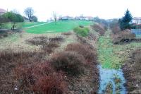
According to the developers a new development, 'Glasgow Harbour', will only be a success if a light rail system is extended from the city to the area. The site of the Meadowside Granary becomes flats, the Meadowside Shipbuilding Yard (intended office, leisure and retail developments) and Merklands Lairage sites are cleared and not developed. The sites are a mile downstream of Glasgow Harbour's Queens Dock and Princes Dock. During development the neighbouring cyclepath, the intact solum of the Lanarkshire and Dumbartonshire Railway, is cleared and partly redeveloped, it being explained that the embankment created a barrier between the development and Partick. The alignment from Smith Street to the Merkland Street Tunnel is obliterated.
  /02/2005Lanarkshire and Dumbartonshire Railway
CCE siding between Dumbarton Central and Dumbarton East cut back to central station.

Portions of line and locations

This line is divided into a number of portions.


Possil to Dumbarton

Double track passenger and goods line from Possil Junction to Dumbarton Central. Between Possil and Maryhill use was made of an old waggonway, rebuilt to railway standard.

This was the junction between the Hamiltonhill Branch (Caledonian Railway) and the Lanarkshire and Dumbartonshire Railway. This was a double track junction.
...

More details

See also
Hamiltonhill Branch (Caledonian Railway)
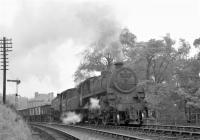
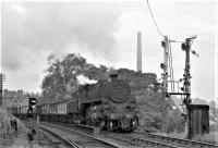
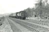
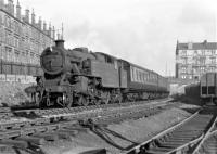
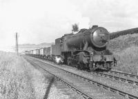
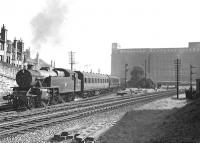
One of Dawsholm shed's WD Austerity 2-8-0s, no 90198, working hard on the approach to Possil Junction on 24 May 1958 with a down coal train. ...
G H Robin collection by courtesy of the Mitchell Library, Glasgow 24/05/1958
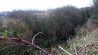
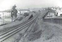
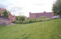
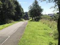
Possil Junction looking east. Here the routes to Hamiltonhill and Dumbarton split before passing under a roadbridge. The alignment of the line here ...
Ewan Crawford 02/02/2008
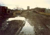
Possil Junction looking west. To the left was the route to Hamiltonhill (cutting infilled) and to the right the route of the line to Dumbarton. ...
Ewan Crawford 02/02/2008
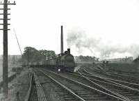
View east over Possil Junction in June 1958. ...
G H Robin collection by courtesy of the Mitchell Library, Glasgow 24/06/1958
4 of 4 images.


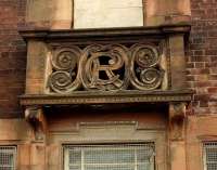
This station is closed but the street level station building and the former goods shed both remain standing. The station building, in red brick, presents a single storey, with two gable ends and attic onto Balmore Road. C and R are on tablets above windows on the south end of the frontage and a coat of arms above the north end. This building, which survived in other uses for many years, is ...

More details
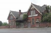
Possil station's booking office is still, just about, standing. The goods yard, with goods shed and weighbridge, remains in operation as Nicholson's ...
John Yellowlees 10/07/2023
1 of 1 images.


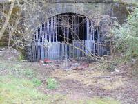
This is a disused double track tunnel between the former Maryhill Central and Possil stations. The tunnel is 808 yds long.
...
More details
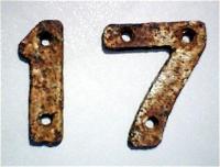
This 17 plate was in the Tamshill Tunnel northwards from former Maryhill [Barracks] Station to Possil Station, Glasgow. They were a distance of ...
Alistair MacKenzie 12/12/1979
1 of 1 images.


This signal box was to the north of Maryhill Central station and Maryhill Road and was south of the tunnel under the Forth and Clyde Canal and Tamshill Tunnel.
...

More details


This was a four platform station. There were two through platforms and, on either side, two bay platforms for terminating services via Glasgow Central. These bays had carriage sidings alongside. Platforms were canopied. The majority of passenger trains terminated here, however the through lines were for passenger trains to Possil and goods and mineral trains running from [[Balornock ...

More details

See also
Glasgow Central Railway
Maryhill Central, photographed on the morning of Saturday 3rd October 1964, on the final weekend of passenger services. ...
Brian Haslehust 03/10/1964
The BLS Bathgate & District Railtour waiting to leave Maryhill Central on 6 May 1961. The special visited various branches between Glasgow and ...
G H Robin collection by courtesy of the Mitchell Library, Glasgow 06/05/1961
View of Maryhill Central station on 25 July 1951 looking north towards Maryhill Road. Dawsholm shed's Stanier 2-6-2T 40153 stands in the sidings on ...
G H Robin collection by courtesy of the Mitchell Library, Glasgow 25/07/1951
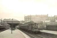
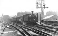
McIntosh ex-CaledonIan 0-4-4T 55168 with a city bound train at Maryhill Central in the summer of 1951. View is north east, with Maryhill Road running ...
G H Robin collection by courtesy of the Mitchell Library, Glasgow 25/07/1951
4 of 7 images. more


This junction was west of Maryhill Central station. The station was on the east side of Garrioch Road and junction on the west side.
...

More details

See also
Glasgow Central Railway
Looking south over the former Glasgow Central Railway viaduct spanning the River Kelvin in May 2011. Kirklee station (closed in May 1939) stood a ...
Veronica Clibbery 07/05/2011
The former Lanarkshire & Dumbartonshire Railway viaduct seen looking south over the River Kelvin on 7 May 2011. Part of the adjacent viaduct built by ...
Veronica Clibbery 07/05/2011
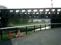
Maryhill Central Junction was off to the left, beyond which was the station. The nearer girder viaduct carried the Lanarkshire and Dumbartonshire ...
Rod Crawford 01/11/2015
1988 view from the girder bridge of the Dumbarton - Balornock line showing the stone arch viaduct of the line from Glasgow Central Low Level with the ...
Ewan Crawford //1988
4 of 14 images. more


This signal box was located on the west to east part of the triangle of lines at Kirklee formed by Bellshaugh Junction (to the west), Maryhill Junction (east) and Kirklee Junction (south). To the immediate east the line crossed over the River Kelvin by a viaduct, one of a pair of viaducts carrying the lines to Maryhill Junction.
...

More details


This goods yard was within the triangle of lines formed by Bellshaugh Junction (to the west), Maryhill Junction (east) and Kirklee Junction (south). The yard was approached from Bellshaugh Junction.
...

More details


This was a four way junction. To the west were the lines to Dawsholm (north west, 1895) and Dumbarton Central (west, 1896). To the east were the lines to Maryhill Central and Balornock Junction (east, 1895) and Glasgow Central (south, 1896). The junction was on a cramped site on the south bank of the River Kelvin, the Dawsholm fork crossing the river immediately north west ...

More details

See also
Glasgow Central Railway
An unusual combination approaching Bellshaugh Junction with a load of mineral wagons from Clydeside on 24th September 1964. Standard Class 4MT 2-6-0 ...
Robin McGregor 24/09/1964
Standard Class 4MT 2-6-0 76101 is seen approaching Bellshaugh Junction with a train of mineral wagons on 24th September 1964. The former home and ...
Robin McGregor 24/09/1964
Caley Jumbo 0-6-0 57341 labours past Bellshaugh Junction with an eastbound freight on 22 September 1959. [Ref query 6530] ...
G H Robin collection by courtesy of the Mitchell Library, Glasgow 22/09/1959
3 of 3 images.


This is a disused double track railway tunnel between the former Kelvinside station and Bellshaugh Junction. The tunnel is 700 yds long.
...
More details
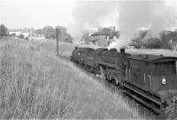
Not long after emerging from Dawsholm depot, an odd-looking combination of Standard 4 2-6-4T 80004 and Standard Class 4 2-6-0 76046 heads
...
Robin McGregor 24/09/1964
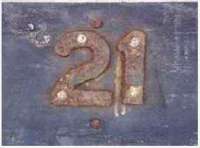
21 in Balgray tunnel north of Kelvinside Station. ...
Alistair MacKenzie 12/12/1979
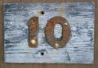
This 10 and similar plates were in the Balgray tunnel northwards from former Kelvinside Station, Great Western Road, Glasgow. They were a ...
Alistair MacKenzie 12/12/1979
Northern Portal of Tunnel, you would not believe that the land behind the photographer is nice and tidy. ...
Colin Harkins 03/05/2008
4 of 6 images. more


This was a two platform station on the south side of Great Western Road with a superb surface building by architect John James Burnet. The station was opened on the Lanarkshire and Dumbartonshire Railway, a protege of the Caledonian Railway.
...

More details
Plates, 1 chain (1 chain = 20.1168 meters) apart, 16 in tunnel south to Crow Road from the former Kelvinside Station (Lux/Stazione Restaurant on Great ...
Alistair MacKenzie //
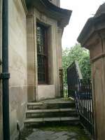
Caledonian Railway Lanarkshire and Dumbartonshire line. Kelvinside Station, now Lux/Stazione Restaurants, showing Front entrance - door now a window. ...
Alistair MacKenzie 22/06/2007
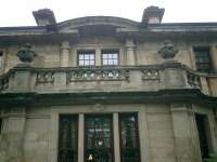
Caledonian Railway Lanarkshire and Dumbartonshire line. Kelvinside Station, now Lux/Stazione Restaurants, showing front CR crest and 1897 date plaque. ...
Alistair MacKenzie 22/06/2007
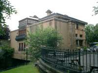
Caledonian Railway Lanarkshire and Dumbartonshire line. Kelvinside Station, now Lux/Stazione Restaurants, rear quarter view. Architect - Sir JJ ...
Alistair MacKenzie 22/06/2007
4 of 18 images. more


This goods yard was operated by the Caledonian Railway although located on the Stobcross Railway, a North British Railway owned line. The Caledonian had running powers to the yard via Maryhill, Cowlairs and Sighthill.
...

More details

See also
Stobcross Railway


As was

...

More details
Ex NB J36 0-6-0 65325 heading back to Dawsholm shed, photographed in June 1963, about to enter the tunnel underneath Hyndland station, on the ...
Robin McGregor 22/06/1963
Standard Class 4MT 2-6-0 76102 propelling a brake van from Clydeside, seen shortly after passing through the closed Crow Road station, on a sunny ...
Robin McGregor 25/01/1964
Fairburn 2-6-4T 42126 has just passed the closed Crow Road station on 11th September 1963 with empty stock, and is about to enter the tunnel ...
Robin McGregor 11/09/1963
The low winter sun catches B1 4-6-0 61008 'Kudu', as it trundles a train of mineral wagons towards Clydeside on 25th January 1964. The train has just ...
Robin McGregor 25/01/1964
4 of 9 images. more


This was a double track junction directly south of Crow Road Tunnel. This was the norther apex of a triangular junction, the other junctions between Partick West Junction and Partick East Junction. The signal box, opened with the junction, was in the 'V' of the junction.
...
More details
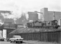
Standard 2MT 2-6-0 78051, propelling a brake van past Partick North junction, on its way back to Dawsholm depot on 1st May 1964. The massive shape of ...
Robin McGregor 01/05/1964
After emerging from the south portal of the tunnel from Crow Road in the summer of 1957, Standard Class 4 2-6-0 76101 has taken the left fork at ...
G H Robin collection by courtesy of the Mitchell Library, Glasgow 07/08/1957
Fairburn 2-6-4T 42200 northbound at Partick North Junction on 2 August 1957 with a Rutherglen - Possil train. The train is about to enter the tunnel ...
G H Robin collection by courtesy of the Mitchell Library, Glasgow 02/08/1957
View south at the former Partick North Junction in 1997 see image 52289. Behind the camera a tunnel runs north to Crow Road, while the Meadowside ...
Ewan Crawford //1997
4 of 4 images.


This was the western junction of a triangle of lines. The other junctions were Partick North Junction and Partick East Junction.
...
More details
Partick West Junction looking west. This bridge has been removed and the emankment levelled despite plans for re-opening some of the line. ...
Ewan Crawford //1988
1 of 1 images.


This station had an island platform with a building typical of the line. Entry was by subway from Ferryden Street.
...
More details
View east towards the flats which have now been built on site of Whiteinch Riverside station. The cycle route returns to street level at this point. ...
Colin McDonald 12/07/2017
The entrance to Whiteinch Riverside station was on Ferryden Street. This 1998 view looking west shows the booking office and entrance under the ...
Ewan Crawford //1998
Harland Cottages, a fine set of four rows of attractive cottages built for Harland and Wolff. ...
Ewan Crawford //
Sustrans' subtle alterations to the abutment of the former Smith Street bridge at the west end of Whiteinch Riverside station, now the start of the ...
Colin McDonald 12/07/2017
4 of 11 images. more


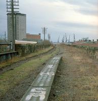
This was an island platform station on a raised embankment. The Whiteinch Tramway passed below. The station building was typical of the line. It competed with the North British Railway's nearby Whiteinch Victoria Park which opened at the same time, 1896, on previously goods only branch.
...
More details
Looking east from the bridge over Edzell Street in 1988. The trackbed was being converted into a footpath. Telegraph poles still stood, there were ...
Ewan Crawford //1988
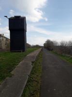
View east towards the Scotstoun East island platform. The black tower in the centre distance is a doocot which has been erected at the west end of the ...
Colin McDonald 12/07/2017
The 'doocot' at the west end of Scotstoun East's island platform in a view looking east. ...
John Yellowlees 05/04/2019
View west along the remains of the island platform at Scotstoun East. The cyclist is passing the site of the station exit. ...
Colin McDonald 12/07/2017
4 of 17 images. more


Looking west at Scotstoun West where the Rothesay Dock Branch and L&DR parted company. The island platform of Scotstoun West is to the left. ...
Ewan Crawford 09/01/2006
Looking west to the junction. To the left were sidings for Yarrows Shipyard. Also to the left was the end of the Clydeside Tramway. ...
Ewan Crawford 09/01/2006
Looking east to Scotstoun West station. This fine girder bridge looks to be in a state of siege. Doocots abound round here. ...
Ewan Crawford 09/01/2006
3 of 3 images.


This was an island platform station. The station was just to the north of Yarrow's Shipbuilding, Engineering and Boilermaking Works partly on a bridge. The station was just west of Scotstoun West Junction. The station building was typical of the line.
...

More details

See also
Clydeside Tramway
Remains of the former Scotstoun West station (closed October 1964), looking east along the island platform towards Glasgow city centre in 1997. ...
Ewan Crawford //1997
Ex-Caledonian 0-6-0T 56167 shunting near Scotstoun West station on 9 August 1957. The sturdy Dock Tank was a resident of Dawsholm shed at that ...
G H Robin collection by courtesy of the Mitchell Library, Glasgow 09/08/1957
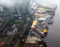
An aerial view with BAE's Scotstoun Yard to the right. To left of the yard was Scotstoun West station and above that the junction with the Rothesay ...
Ewan Crawford 20/07/2011
3 of 3 images.


This coal fired power station was located to the south of the Lanarkshire and Dumbartonshire Railway which served it, via a reversal. Yoker Ferry station was to the immediate west. It was also accessible from the marshalling yard of Rothesay Dock. The site was bounded to the south by the River Clyde.
...

More details


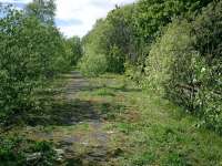
This was an island platform station with a building typical of the Lanarkshire and Dumbartonshire Railway. The line was on a raised embankment.
...
More details
Lanarkshire and Dumbartonshire Railway, Yoker Riverside Station. This was an island platform station on an elevated line at this point, looking E. ...
Alistair MacKenzie 09/05/2007
Lanarkshire and Dumbartonshire Railway, Yoker Riverside Station. This was an island platform station on an elevated line at this point. ...
Alistair MacKenzie 09/05/2007
Lanarkshire and Dumbartonshire Railway, Yoker Riverside Station. This was an island platform station on an elevated line at this point, looking W. ...
Alistair MacKenzie 09/05/2007
View north-east from the island platform looking over the Rothesay Dock branch. ...
Ewan Crawford 12/06/2007
4 of 15 images. more


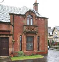
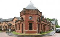
This station is closed, however the very fine booking office still stands.
...
More details
The former booking office at Clydebank Riverside, seen here standing in the rain in June 2010, more than 45 years after closure to passengers. The ...
John Furnevel 08/06/2010
A rainy day in Clydebank, looking north west at the corner of Cunard Street and Atlas Street in 2010. The scrollwork on the balcony incorporating the ...
John Furnevel 08/06/2010
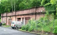
Caledonian Railway Lanarkshire and Dumbartonshire line, Clydebank Riverside Station (serving John Browns shipyard). Architect was J. J. Burnet. ...
Alistair MacKenzie //
Lanarkshire and Dumbartonshire Railway, CR crest on the station building at Clydebank Riverside. Architect J. J. Burnet. ...
Alistair MacKenzie //
4 of 16 images. more


This goods yard was between Kilbowie station and Clydebank Riverside. It was on the south/west side of the line. Approach was from the goods loop on the south side of Kilbowie station.
...

More details
40188 approaching Kilbowie with a Rutherglen - Balloch train in September 1957. ...
G H Robin collection by courtesy of the Mitchell Library, Glasgow 27/09/1957
1 of 1 images.


This junction was at the east end of Kilbowie station. This station had goods loops on either side of its platform lines. The east end of the loop was controlled by Clydebank Goods Junction signal box on the north side of the line.
...

More details


This swing bridge crossed the Forth and Clyde Canal in Clydebank, near Kilbowie Road station. It linked the Lanarkshire and Dumbartonshire Railway, on the south bank of the canal, to the Singer Works, on the north bank.
...

More details


This was an island platform station on a raised embankment to the west of Kilbowie Road. The station building was typical of the line and there were not just platform lines but loops on either side of the island platform.
...

More details
Ex-Caledonian 0-6-0 57564 leaves Kilbowie on 27 September 1957 with a Rutherglen - Balloch train. ...
G H Robin collection by courtesy of the Mitchell Library, Glasgow 27/09/1957
Still known as The Caley Bridge this carries the stub which today only runs from Clydebank to the rubbish disposal site near the HCI/Millennium ...
Ewan Crawford 09/01/2006
2 of 2 images.


This was a spacious four platform station, two being terminal platforms on the north side and the main route being served by an island platform. Access was by footbridge from Auld Street.
...

More details
Standard Class 4 2-6-0 76074, ready to leave Dalmuir Riverside with the final service to Rutherglen, on 3rd October 1964. The Central Low Level line ...
Brian Haslehust 03/10/1964
A Gloucester DMU at Dalmuir Riverside, on the last day of passenger traffic at the station, 3rd October 1964. ...
Brian Haslehust 03/10/1964
Caledonian Railway Lanarkshire and Dumbartonshire line, bridge below Beardmore Street bridge, looking from W. ...
Alistair MacKenzie 04/05/2007
Caledonian Railway Lanarkshire and Dumbartonshire line, bridge over Agamemnon Street looking E. ...
Alistair MacKenzie 04/05/2007
4 of 38 images. more


This short lived signal box was west of Dalmuir Riverside. It controlled access to the Clyde Trust's Dalmuir Dredger Works, the west end of Beardmore's Dalmuir Naval Construction Yard, and the Dalmuir Sewage Purification Works. These were on the south side of the main line and on the north bank of the River Clyde.
...

More details


This siding was on the south side of the Lanarkshire and Dumbartonshire Railway midway between the former Dalmuir Riverside (to the east) and Old Kilpatrick stations. Approach was from the west. The siding was served by trains from Chivas Bros Siding [Keith].
...

More details
Caledonian Railway Lanarkshire and Dumbartonshire line, trackbed looking W at rear of Chivas Regal/Pernod/Ricard Plant. ...
Alistair MacKenzie 04/05/2007
Chivas Bros Siding was the last siding in use on what became a branch from Clydebank Central Junction. For a view of the siding during its last ...
Ewan Crawford 25/02/2020
Just west of Dalmuir Riverside was the Chivas Regal bottling site. The line is lifted here now. ...
Ewan Crawford //1987
West of Clyde Trust Siding was Chivas Regals bottling rail-served plant. ...
Ewan Crawford //1987
4 of 4 images.


This was a two platform station in slight cutting below road level. There were Caledonian Railway style buildings on the platforms (the westbound platform building was the larger) and ramps to street level. The passenger station was on the north side of the Erskine Ferry Road.
...
More details
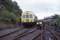
This is the BLS tour of 24/08/1974 at the east end of the former goods yard at Old Kilpatrick station. By this date the sidings here served a ...
Roger Geach Collection 24/08/1974
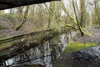
Old Kilpatrick bearing some resemblance to the Forth and Clyde Canal, running just beyond the view to the left. The view looks east. Remarkably ...
Ewan Crawford 25/02/2020
Caledonian Railway Lanarkshire and Dumbartonshire line, view of trackbed and sidings at Old Kilpatrick Goods Yard, looking E from bridge over Ferry ...
Alistair MacKenzie 25/04/2007
Caledonian Railway Lanarkshire and Dumbartonshire line, sleepers piled to side. ...
Alistair MacKenzie 25/04/2007
4 of 13 images. more


This quay was on the north bank of the River Clyde east of Bowling and west of Old Kilpatrick. It was named for Robert Donald of Mountblow House. It was the northern pier of a former route of the Erskine Ferry (Erskine House is just across the Clyde and the landowner Lord Blantyre owned land on either side of the river) known as the Ferrydyke and additionally saw use as a coal ...

More details
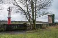
On the left is Donald's Quay Light, a navigation mark on the north bank of the River Clyde between Bowling and Old Kilpatrick. The structure on the ...
Ewan Crawford 25/02/2020
1 of 1 images.


The Lanarkshire and Dumbartonshire Railway had a second lesser known swing bridge which was directly south of the main Bowling Swing Bridge. A line from Bowling Harbour Signal Box ran west to serve the east end of Bowling Basin and then cross the lower basin to reach the quaysides in Bowling Basin and Bowling Harbour. Here it connected with the sidings of the [[Glasgow, Dumbarton and ...

More details
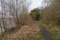
View west near Bowling Harbour Signal Box in February 2020. The trackbed has nearly reverted to nature. For a view of the line here while open see ...
Ewan Crawford 25/02/2020
View west at the site of Bowling Harbour Signal Box (which was to the right, behind the camera). The viaducts through Bowling are being restored and ...
Ewan Crawford 25/02/2020
Stanier 3P 2-6-2T 40200 runs along the north bank of the River Clyde near Bowling on 12 April 1958 at the head of a Dumbarton Central - Rutherglen ...
G H Robin collection by courtesy of the Mitchell Library, Glasgow 12/04/1958
3 of 3 images.


This double track swing bridge crosses the Forth and Clyde Canal between the upper and lower basins at Bowling. A signal box was mounted above the running lines to the immediate west of the bridge. The pivot of the bridge was just to the east of the box and the bridge's east end swung north. The bridge was moved hydraulically. It carried the 1896 Lanarkshire and Dumbartonshire Railway. The ...

More details
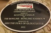
Bowling's 'Bowline' wins at the National Railway Heritage Awards. Other Scottish winners were Stirling rooves, Aberdeen Station north block ...
John Yellowlees 06/12/2022
Alex Hynes presenting an NRHA plaque to Scottish Canals for the restoration of 'Bowline viaduct' as a new cycleway in Bowling. [This is not a single ...
Network Rail 11/07/2023
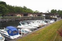
View over a crowded canal basin at Bowling at the western end of the Forth and Clyde Canal in June 2010. Running across the centre is the route of ...
John Furnevel 08/06/2010
Caledonian Railway Lanarkshire and Dumbartonshire line, bridge over Forth and Clyde Canal. ...
Alistair MacKenzie 13/04/2007
4 of 18 images. more


This was an island platform station. The station building was typical of the line. The railway was to the north of and above the town and Bowling Harbour. Entrance was by a subway with a station frontage at street level on the south side of the line. The subway emerged at the west end of the platform.
...
More details
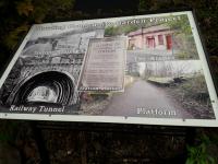
Display board at the community garden project at Bowling, showing the history of the old Caledonian/LMS railway station which the project has been ...
John Yellowlees 08/02/2022
View west along Scott Avenue, Bowling, in June 2010, showing the frontage of the former Lanarkshire and Dumbartonshire railway station, almost 50 ...
John Furnevel 08/06/2010
Caledonian Railway Lanarkshire and Dumbartonshire line, Bowling looking West. ...
Alistair MacKenzie 13/04/2007
Looking west along what would have been the Up Line at Bowling (CR) or as the closure notice of February 1951 advised 'Bowling (LMS)' with alternative ...
John McIntyre 02/06/2019
4 of 35 images. more


These sidings were west of Bowling [CR] station. These were accessed from the west by reversal, there was a ground frame.
...

More details


This very short tunnel, with highly ornamental portals with armorial plaque at the east, carried the eastern driveway to Auchentorlie House, to the north west. The tunnel was to provide sufficient length to blind the railway from the driveway to avoid scaring horses. The tunnel was west of Bowling [CR].
...
More details
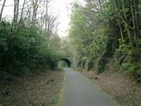
Caledonian Railway Lanarkshire and Dumbartonshire line, Bowling looking West. ...
Alistair MacKenzie 13/04/2007
Caledonian Railway Lanarkshire and Dumbartonshire line, bridge built 1895. Detailed stone facing and cast-in-situ concrete lining. ...
Alistair MacKenzie 13/04/2007
Tunnel to the west of Bowling station. The plaque has the date of construction of the railway 1895. ...
Ewan Crawford //
3 of 3 images.


A class 318 works ecs South towards Glasgow. Taken from a footpath/cyclepath behind our hotel before dinner! ...
Ken Strachan 14/07/2015
311107 heads east with Dumbuck hill in the background and the (in 1990) new path in the foreground. The train is running on the short section of the ...
Ewan Crawford //1990
2 of 2 images.


This gas works was opened by the Dumbarton Town Council Gas Department in 1923. The works was initially on the north side of the Lanarkshire and Dumbartonshire Railway and expanded in 1954 to include a further gasometer on the west/south side of the line. It was absorbed by the Scottish Gas Board in 1949.
...

More details


This junction opened with the line to serve Leven Shipbuilding Yard (the Denny's shipyard thus the original name of Denny's Siding). The branch was on the south/west side of the line, approached from the east, as the westbound main line curved north towards Dumbarton East.
...
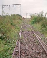
More details
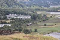
The line from the Leven Shipyard climbed to reach the L&D east of Dumbarton East station. By 1991 the track was still in place but points taken ...
Ewan Crawford //1991
The overgrown remains of the exchange sidings at Leven Shipyard Junction as seen in 1991. In the distant background is a fabrication shed at the ...
Ewan Crawford //1991
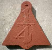
1/4 MP sign. Triangular metal plate with bolt projections top and bottom and low relief numerals 1/4 of black figures on white. Found on timber post ...
Alistair MacKenzie 06/03/1980
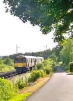
A Class 320 EMU approaches Dumbarton East along the north bank of the Clyde, as seen from the ramparts of Dumbarton Castle on 3rd August 2017. ...
Mark Bartlett 03/08/2017
4 of 7 images. more


This single ended two road shed was close to Dumbarton East station. It was located in the 'V' of the junction between the main line and the goods line approaching Dumbarton East Goods (also known as Dumbarton South Goods). The shed was approached by reversing from the goods yard (to the west).
...
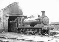
More details
J36 0-6-0 no 65335 stands outside the 2 road shed by Dumbarton East on 26 November 1960. Latterly a sub to 65D Dawsholm, the shed closed in October ...
G H Robin collection by courtesy of the Mitchell Library, Glasgow 26/11/1960
1 of 1 images.


This goods yard, also known as Dumbartion South Goods, was on the south side of the line curving from Dumbarton East to Dumbarton Central. It was approached from the south (the west side of Dumbarton East).
...

More details
Dumbarton East goods shed seen looking north from Glasgow Road. This location is now occupied by the eastern extension of the St James Retail Park. ...
Ewan Crawford //1996
1 of 1 images.


This is an island platform station. The station features street level entry, which formerly had a booking office. The island platform building (similar to those at Dumbarton Central) no longer exists but a waiting shelter is provided.
...

More details
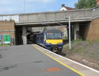
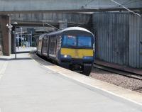
334034, with an Edinburgh to Helensburgh Central service, calls at Dumbarton East on 14th October 2017.
...
David Panton 14/10/2017
320321 arrives at Dumbarton East with an eastbound service on 22 November 2011. ...
John McIntyre 22/11/2011
A 334 on an Edinburgh service calls at Dumbarton East on 01/04/2017. ...
David Panton 01/04/2017
Seen across the Dumbarton rooftops, from the ramparts of the Castle, a Class 320 EMU pauses at the East station on its way to Balloch. 3rd August ...
Mark Bartlett 03/08/2017
4 of 19 images. more


This junction was directly east of Dumbarton Central station. It was formed in 1896. Here the former Caledonian and Dumbartonshire Junction Railway of 1850 (now owned by the North British Railway) was met by the newly opened Lanarkshire and Dumbartonshire Railway.
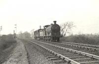
...

More details

See also
Caledonian and Dumbartonshire Junction Railway
J37 0-6-0 64472 passing Dumbarton East Junction in April 1958 with two brake vans. ...
G H Robin collection by courtesy of the Mitchell Library, Glasgow 12/04/1958
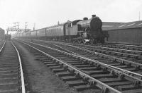
V3 67625 photographed at Dumbarton East Junction on 12 April 1958 at the head of a Helensburgh - Bridgeton train. ...
G H Robin collection by courtesy of the Mitchell Library, Glasgow 12/04/1958
Looking south at 303 approaching Dumbarton East. Viewed from the closed NB line in Dumbarton. Dumbarton Central and the former junction are to the ...
Ewan Crawford //1987
A down West Highland train coasts through Dumbarton East Junction on 12 April 1958. Locomotives are Black 5 44973 and K2 61787 Loch Quoich. ...
G H Robin collection by courtesy of the Mitchell Library, Glasgow 12/04/1958
4 of 5 images. more


Stobcross to Partick

Double track passenger and goods line from Exhibition Centre to Partick West Junction.

This station is at the east end of a flying junction from Partick, leading to an unusual V shape.
...

More details

See also
Glasgow Central Railway
318258 at Exhibition Centre station, lost beneath ghastly concrete slip roads for the monstrous M8 motorway and seen from the open top Glasgow city ...
David Bosher 06/09/2022
303019 leaves Exhibition Centre, Glasgow, with a westbound service in February 1988.
...
Bill Roberton /02/1988
A Whifflet service calls at Exhibition Centre on 7 July. The Up and Down lines come together at this end of the platform, having made their own, ...
David Panton 07/07/2018
A service for Dalmuir via Yoker calls at Exhibition Centre on 13 July 2019. The track on the right is a siding (buffers behind me) used by the few ...
David Panton 13/07/2019
4 of 18 images. more


This junction was located in the tunnel just west of Stobcross station (now Exhibition Centre).
...

More details


This double track tunnel originally ran from Kelvinhaugh Signal Box to the west to Stobcross station to the east. It closed in 1965. The original tunnel is 755 yds long.
...

More details


This signal box was on girders above the Lanarkshire and Ayrshire Railway in a short stone lined cutting north of Kelvinhaugh Street. Yorkhill Tunnel was to the north, Kelvinhaugh Tunnel to the south. ...

More details


This mill near Partick was on the east bank of the River Kelvin. It was built on the site of the Bunhouse Mill.
...

More details


This was an island platform station with a street level building on Benalder Street and platform building.
...

More details
A short section of platform remains under the bridge at the former station. ...
Martin MacGuire 20/05/2023
The site of Kelvin Hall station looking east in 1980. The station closed to passengers in 1964 as Kelvin Hall but from opening in 1896 until 1959 when ...
John Clark //1980
Kelvin Hall station decorated for the Scottish Industries Exhibition in September 1959. ...
David Murray-Smith /09/1959
3 of 3 images.


This junction was to the immediate east of Partick West station, that station being built on the lines approaching the junction. This was the east junction of a triangular junction, the northern apex being Partick North Junction and western Partick West Junction.
...

More details

See also
Clydeside Tramway
Fairburn 2-6-4T 42125 approaches Partick West on an afternoon service from Rutherglen to Dalmuir Riverside in March 1964. The fine tenements on ...
Robin McGregor 25/03/1964
1 of 1 images.


Site of Partick West looking east to Partick East Junction. There were 3 westbound platforms here and to the left 2 northbound platforms. Meadowside ...
Ewan Crawford //1988
Looking west along Castlebank Street/South Street. The tarmac laid across the road where the line entered the Meadowside Granary to left. The line to ...
Ewan Crawford //1988
Site of Partick West looking west to Partick West Junction. There were 3 westbound platforms here and to the right 2 northbound platforms. Meadowside ...
Ewan Crawford //1988
Looking west along Castlebank Street/South Street by the remains of Partick West station (right). Here began the Clydeside Tramway (foregound right to ...
Ewan Crawford //1988
4 of 7 images. more


This was the western junction of a triangle of lines. The other junctions were Partick North Junction and Partick East Junction.
...

More details
Partick West Junction looking west. This bridge has been removed and the emankment levelled despite plans for re-opening some of the line. ...
Ewan Crawford //1988
1 of 1 images.


Partick East Junction to Partick North Junction

Partick East Junction to Partick North Junction.

This was a double track junction directly south of Crow Road Tunnel. This was the norther apex of a triangular junction, the other junctions between Partick West Junction and Partick East Junction. The signal box, opened with the junction, was in the 'V' of the junction.
...

More details
Standard 2MT 2-6-0 78051, propelling a brake van past Partick North junction, on its way back to Dawsholm depot on 1st May 1964. The massive shape of ...
Robin McGregor 01/05/1964
After emerging from the south portal of the tunnel from Crow Road in the summer of 1957, Standard Class 4 2-6-0 76101 has taken the left fork at ...
G H Robin collection by courtesy of the Mitchell Library, Glasgow 07/08/1957
Fairburn 2-6-4T 42200 northbound at Partick North Junction on 2 August 1957 with a Rutherglen - Possil train. The train is about to enter the tunnel ...
G H Robin collection by courtesy of the Mitchell Library, Glasgow 02/08/1957
View south at the former Partick North Junction in 1997 see image 52289. Behind the camera a tunnel runs north to Crow Road, while the Meadowside ...
Ewan Crawford //1997
4 of 4 images.


This was a five platform station built on two curves of a triangular junction. There were three platforms on the east-west route from Dumbarton Central to Glasgow Central Low Level (two westbound on either side of an island platform and one eastbound) and two platforms on the east-north route from Possil to Glasgow Central Low Level.
...

More details
Site of Partick West looking east to Partick East Junction. There were 3 westbound platforms here and to the left 2 northbound platforms. Meadowside ...
Ewan Crawford //1988
Looking west along Castlebank Street/South Street. The tarmac laid across the road where the line entered the Meadowside Granary to left. The line to ...
Ewan Crawford //1988
Site of Partick West looking west to Partick West Junction. There were 3 westbound platforms here and to the right 2 northbound platforms. Meadowside ...
Ewan Crawford //1988
Looking west along Castlebank Street/South Street by the remains of Partick West station (right). Here began the Clydeside Tramway (foregound right to ...
Ewan Crawford //1988
4 of 7 images. more


This junction was to the immediate east of Partick West station, that station being built on the lines approaching the junction. This was the east junction of a triangular junction, the northern apex being Partick North Junction and western Partick West Junction.
...

More details

See also
Clydeside Tramway
Fairburn 2-6-4T 42125 approaches Partick West on an afternoon service from Rutherglen to Dalmuir Riverside in March 1964. The fine tenements on ...
Robin McGregor 25/03/1964
1 of 1 images.


Bowling Harbour Branch

This short branch left the main line east of Bowling station and ran on the south side of the line on a descent to meet the lower canal basin on its east side. The line continued by means of a low level swing bridge over the canal, to the immediate south of the more famous and still standing swing bridge, to reach exchange sidings with the Glasgow, Dumbarton and Helensburgh Railway and serve the harbour quayside.

The Lanarkshire and Dumbartonshire Railway had a second lesser known swing bridge which was directly south of the main Bowling Swing Bridge. A line from Bowling Harbour Signal Box ran west to serve the east end of Bowling Basin and then cross the lower basin to reach the quaysides in Bowling Basin and Bowling Harbour. Here it connected with the sidings of the [[Glasgow, Dumbarton and ...

More details
View west near Bowling Harbour Signal Box in February 2020. The trackbed has nearly reverted to nature. For a view of the line here while open see ...
Ewan Crawford 25/02/2020
View west at the site of Bowling Harbour Signal Box (which was to the right, behind the camera). The viaducts through Bowling are being restored and ...
Ewan Crawford 25/02/2020
Stanier 3P 2-6-2T 40200 runs along the north bank of the River Clyde near Bowling on 12 April 1958 at the head of a Dumbarton Central - Rutherglen ...
G H Robin collection by courtesy of the Mitchell Library, Glasgow 12/04/1958
3 of 3 images.


This tidal harbour, today associated with old hulks lying in the mud exposed at the low tide, is the western entry to the Forth and Clyde Canal. It is enclosed by two structures, a dyke to the west (built 1856 by the Clyde Trustees) and the eastern (built 1846) which was a long timber quayside, now almost totally gone. It was laid out in 1846 when a new sea lock from the western side of ...

More details

See also
Caledonian and Dumbartonshire Junction Railway


Rutherglen Terminus

Although not part of the line, but located on the Glasgow Central Railway, platforms 3, 4 and 5 (old numbering) at Rutherglen were developed to be terminal platforms for trains from Balloch and Dumbarton.

This junction was replaced by the present Rutherglen North Junction, the present junction being south of the former Clydebridge Junction (the original Rutherglen North Junction [1st] was further south).
...

More details

See also
Dalmarnock Branch (Caledonian Railway)
Glasgow Central Railway
The Switchback (Caledonian Railway)
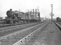
42243 approaching Rutherglen station on 17 May 1957 with a terminating service from Balloch. ...
G H Robin collection by courtesy of the Mitchell Library, Glasgow 17/05/1957
1 of 1 images.


These carriage sidings were opened in 1896 as part of the Glasgow Central Railway. There were three bay platforms just to the west and services both started and ended at Rutherglen [4th]. The terminal platforms and carriage sidings were controlled by Rutherglen Noth Junction box which looked out over the area.
...

More details


With the opening of the Glasgow Central Railway a further six platforms were to open at Rutherglen, in addition to the existing six (two on the west to north curve and four on the mainline).
...

More details